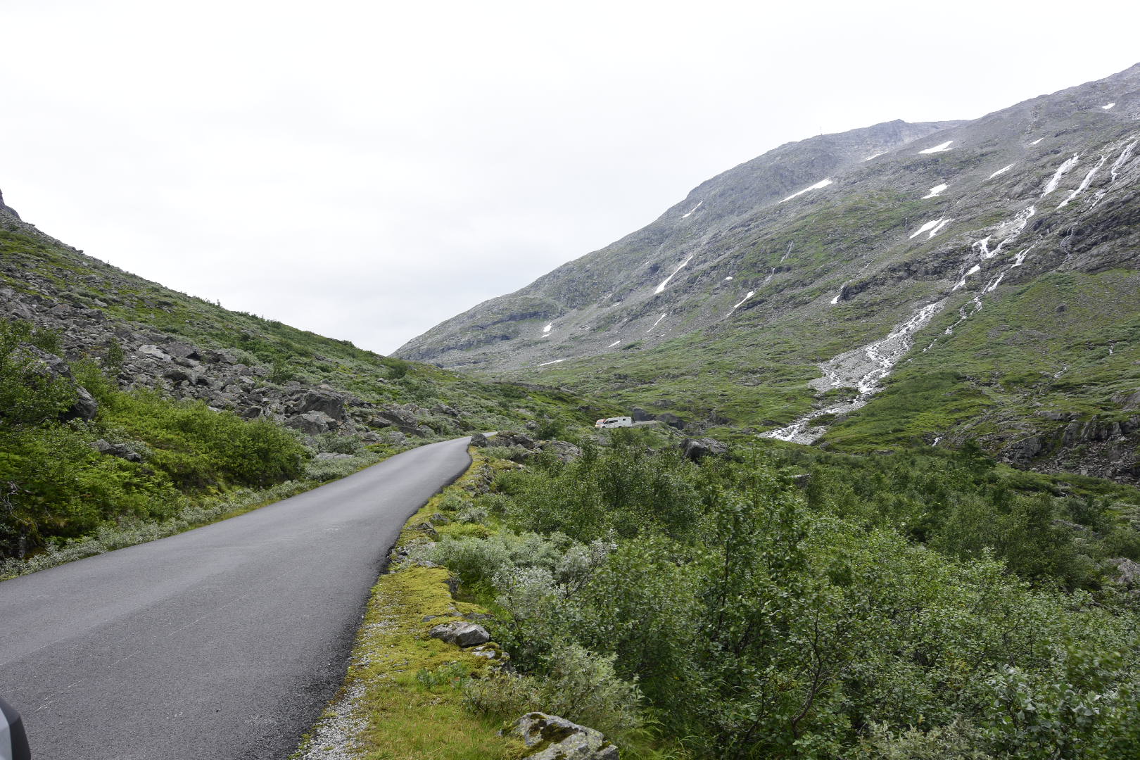
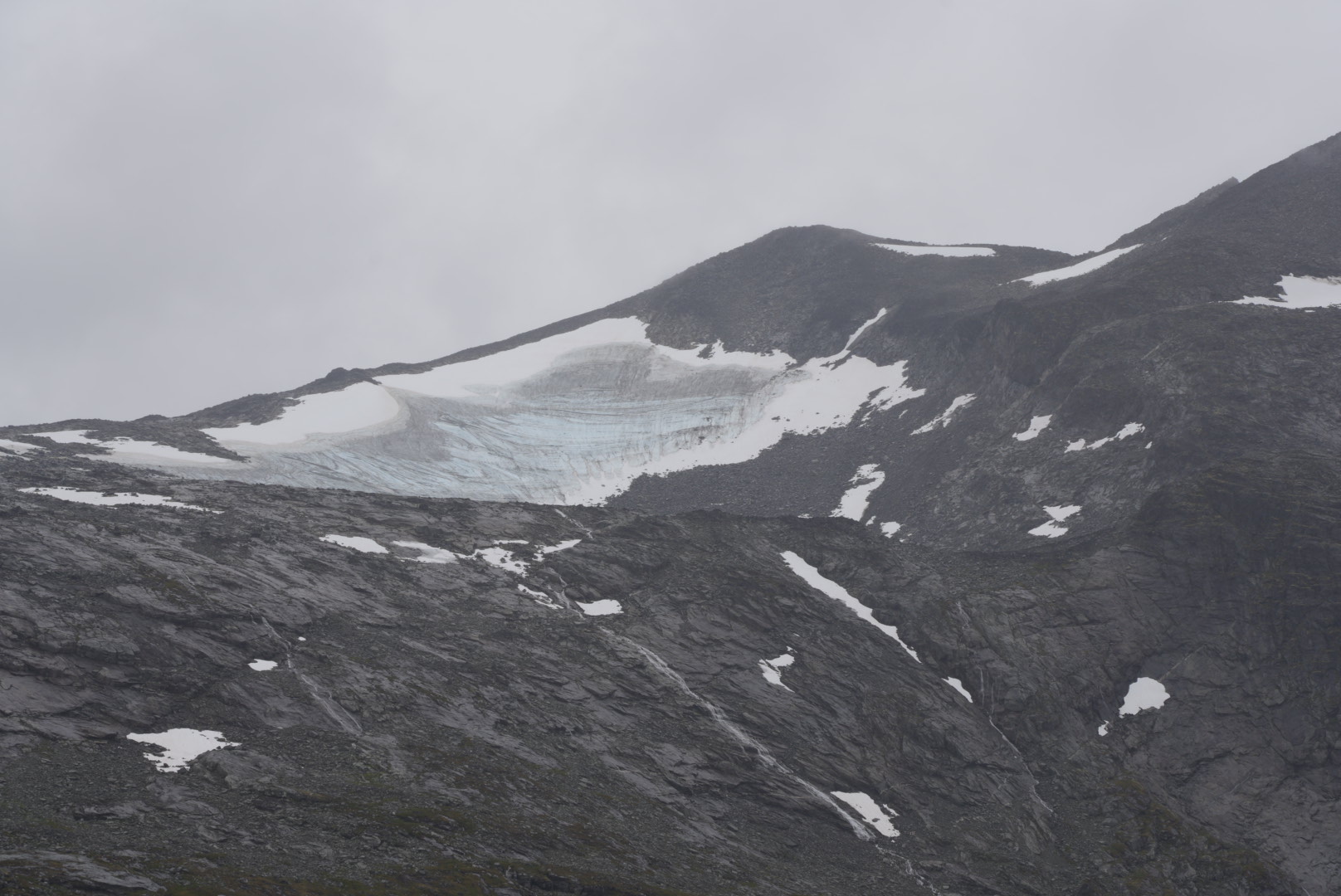
Game Strynfjell
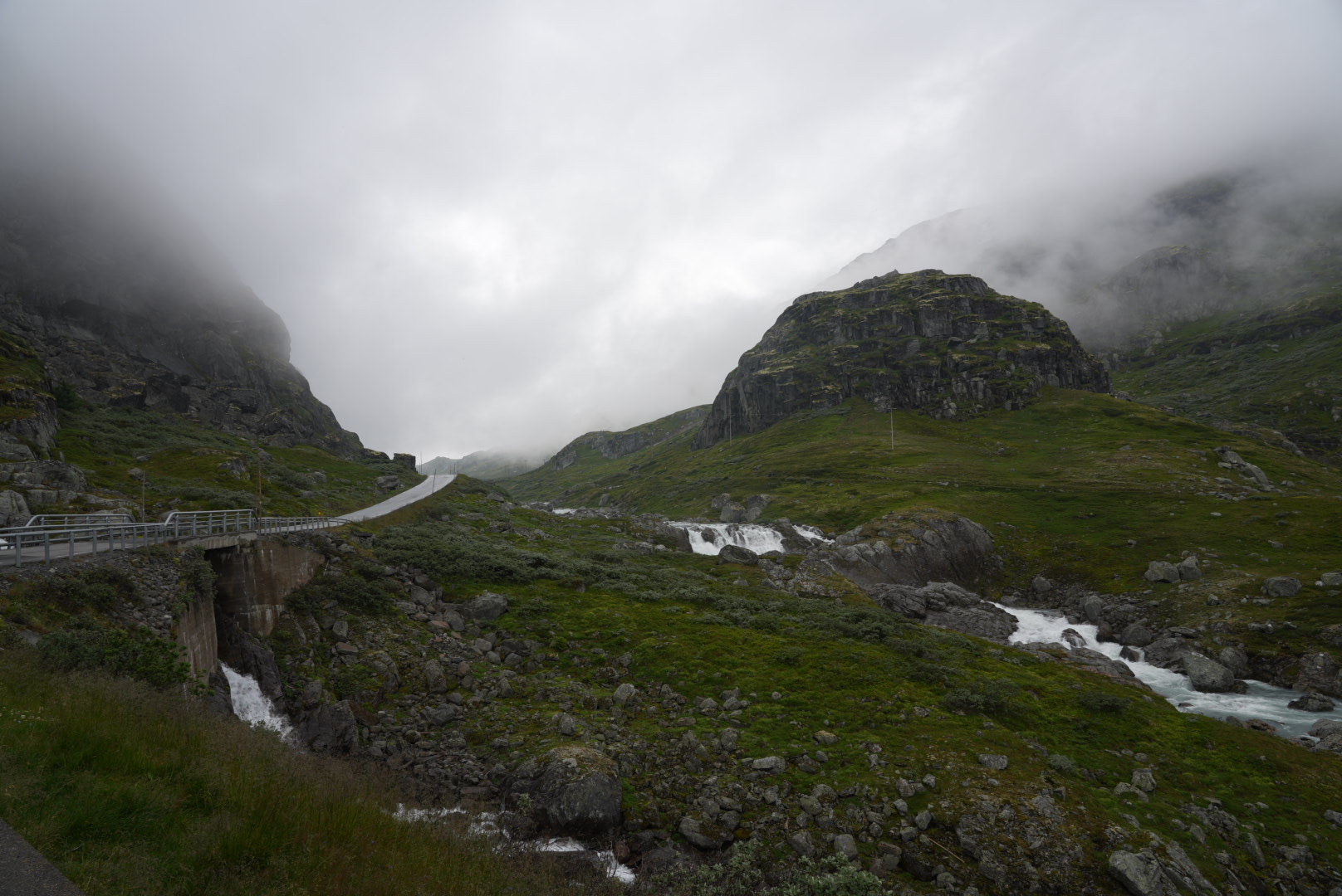
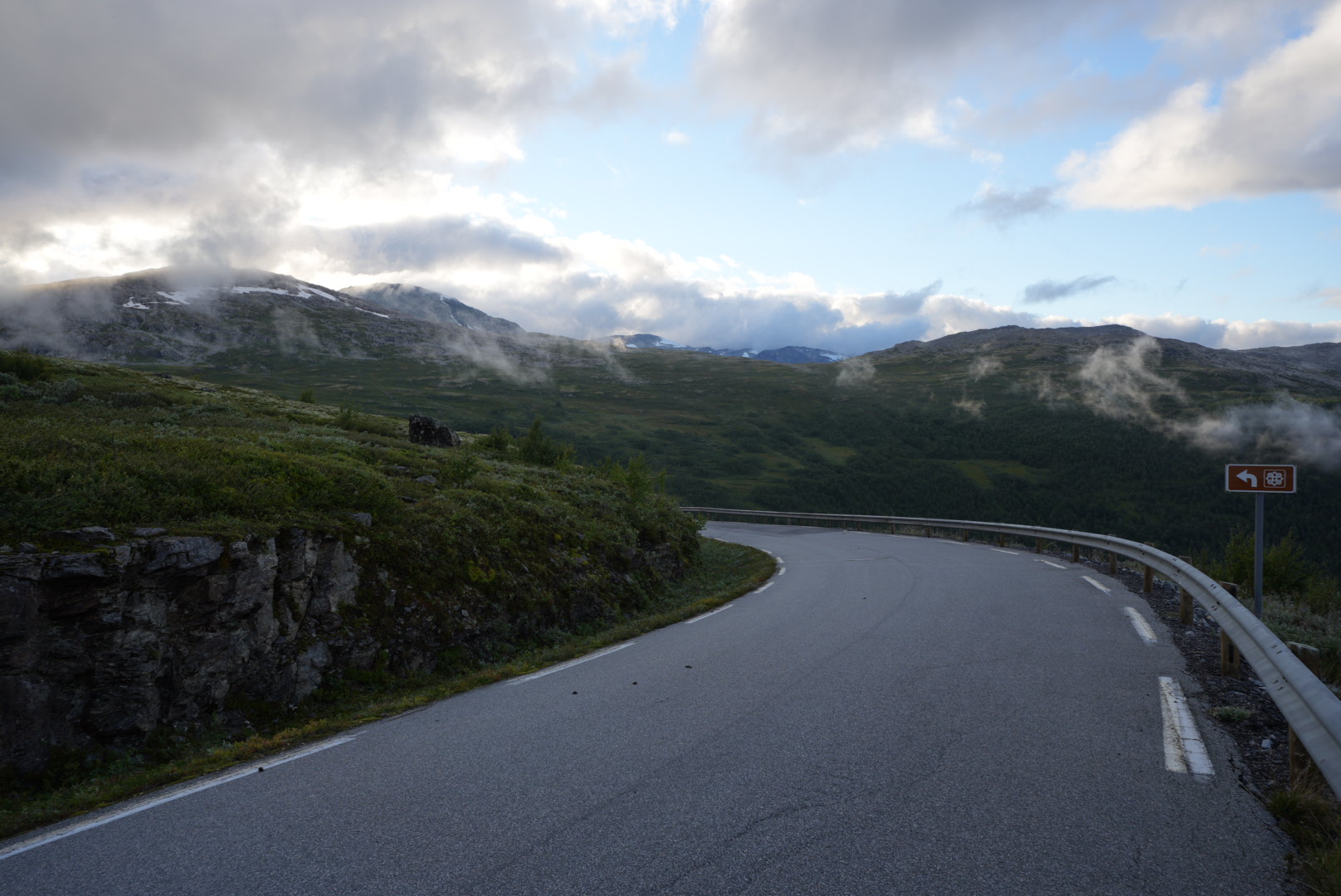
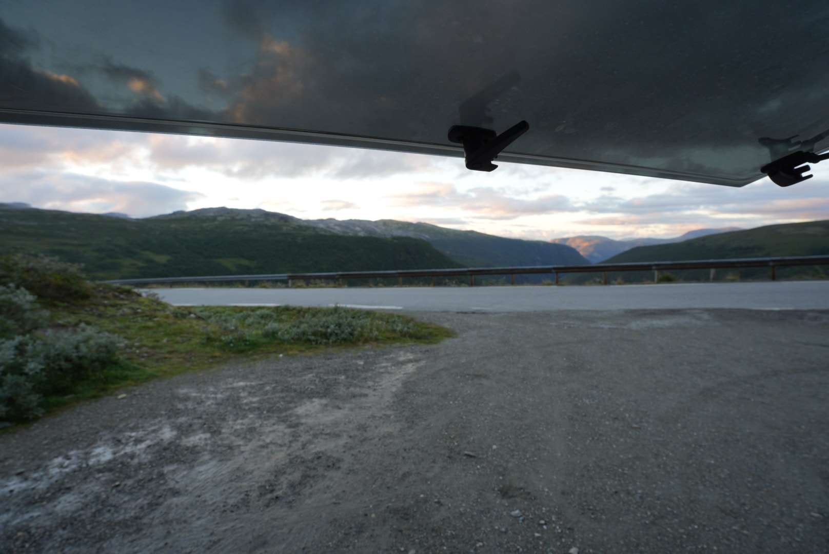
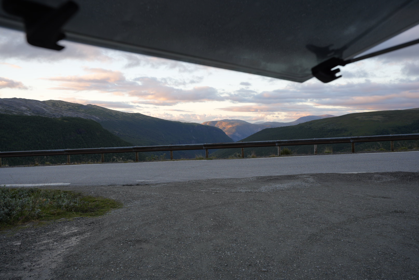
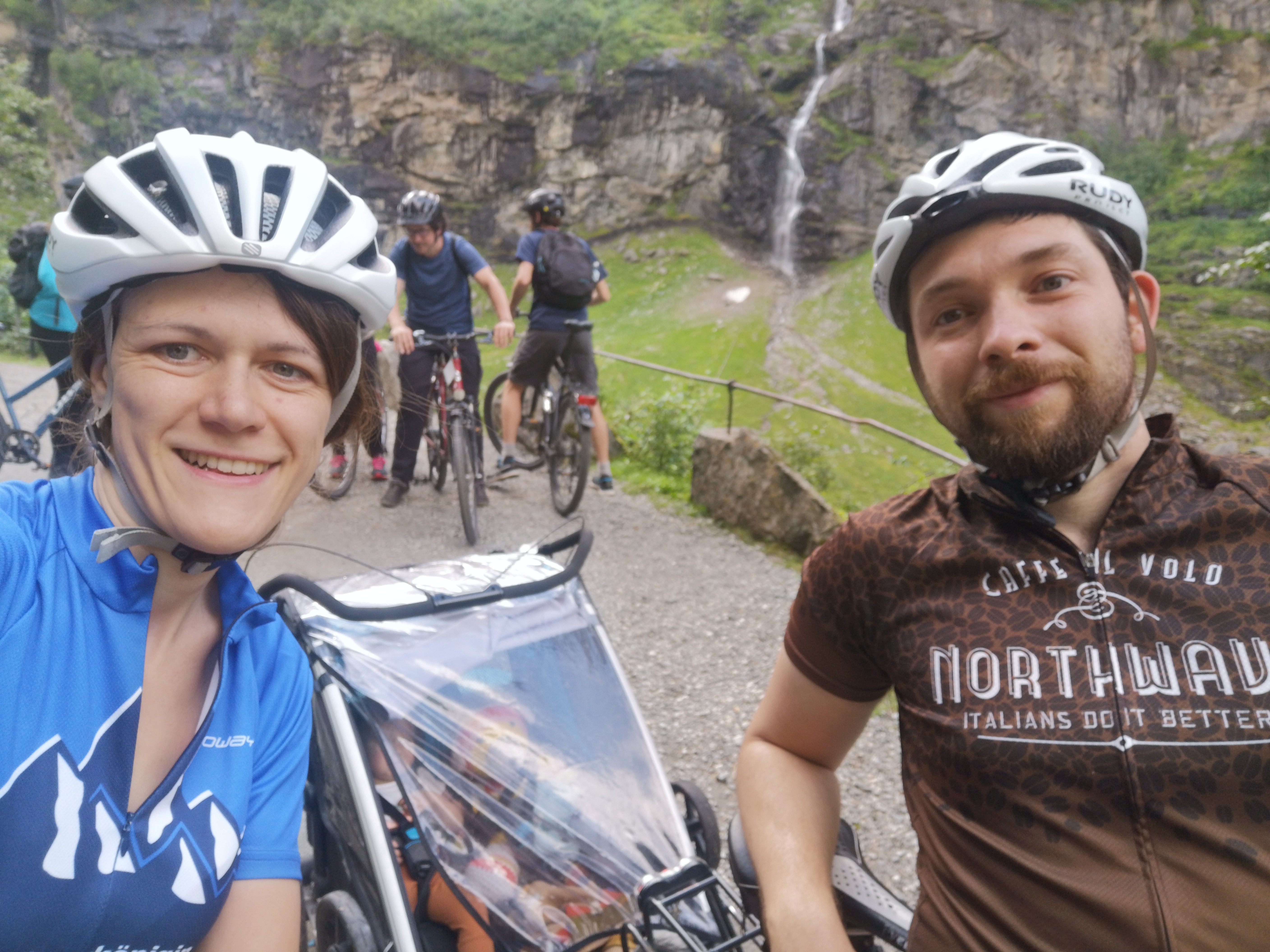
In a YouTube video we found the tip to make a detour via the tourist road “Gamle Strynefjellsvegen”. This is an old connecting path between two valleys. It leads over the Strynefjell, a plateau, and has now been replaced by several tunnels for everyday journeys. The old path was laid out by hand as early as the late 1800s. But what remains is a wonderful route through a wasteland that is apparently not frequented by many. Here we are almost alone and only meet a few other people. The weather is too bad for us to stop and so we just enjoy the view while our mouse is shaken off the gravel road into a quiet nap.
Of course, we still made a few photo stops to show you the landscape.


Lom
At the end of this road we come back to our original route and continue to Lom. We were here a few days ago and are returning to the tried-and-tested cafeteria. We finally have some videos to upload again. We can also do a small shopping stop, since the supermarket is opposite. This makes it easier with the mouse and it is enough if one quickly walks over and the other makes the café unsafe with the mouse.
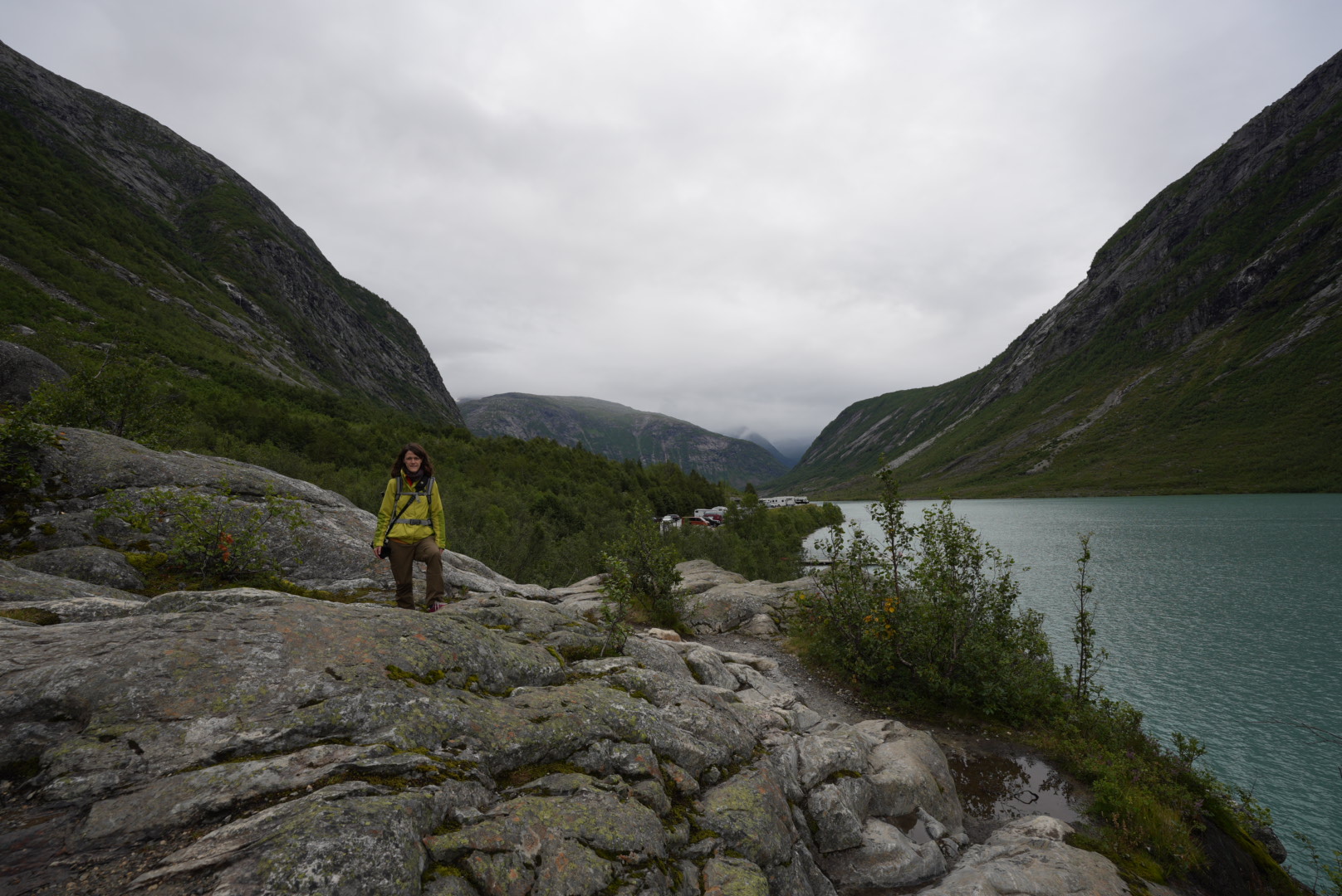
Leirdal
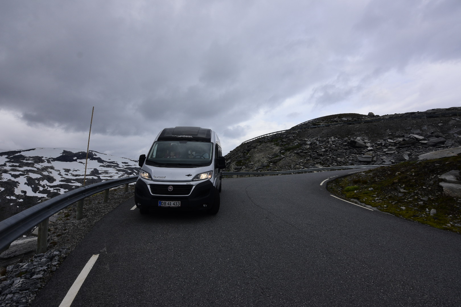
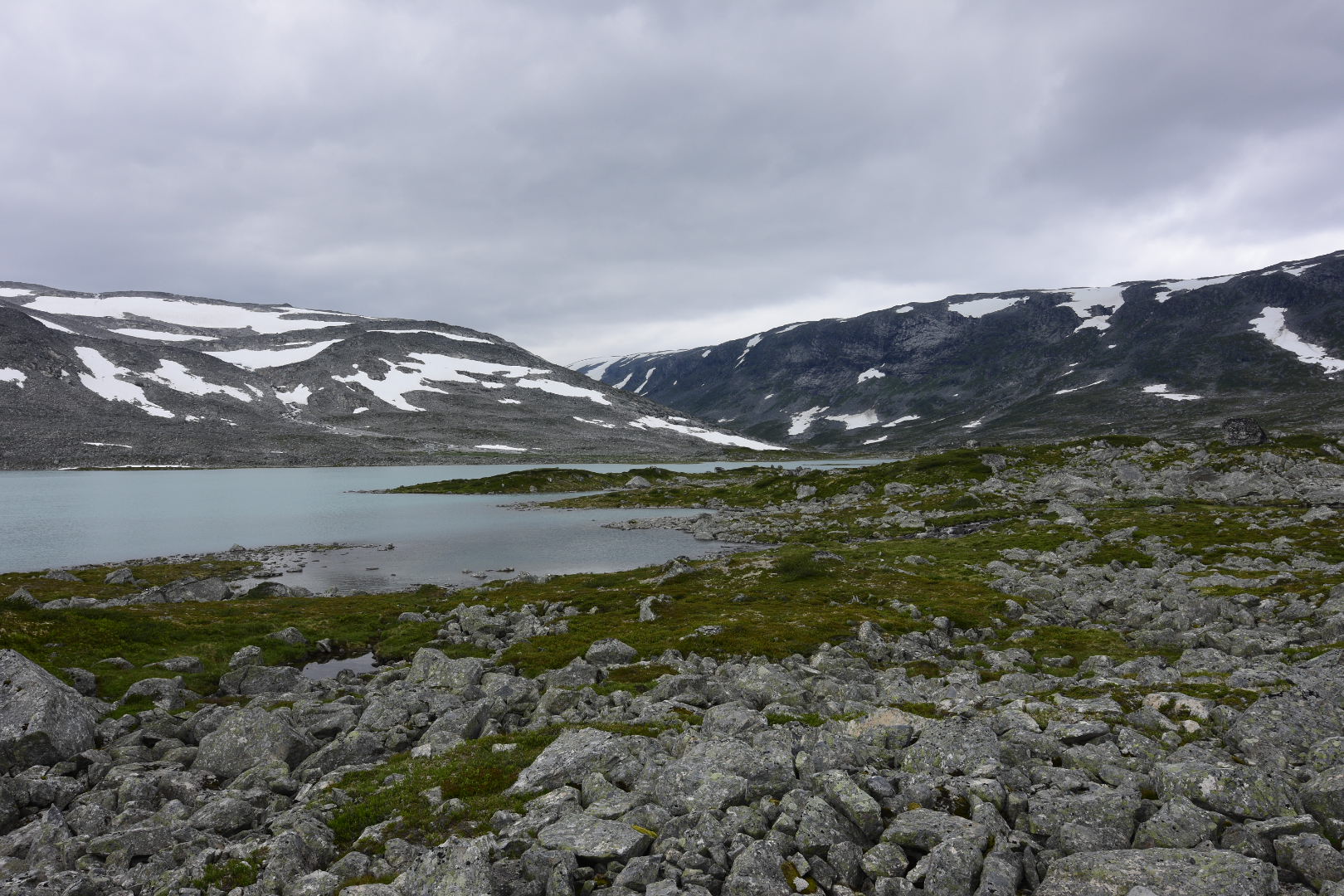
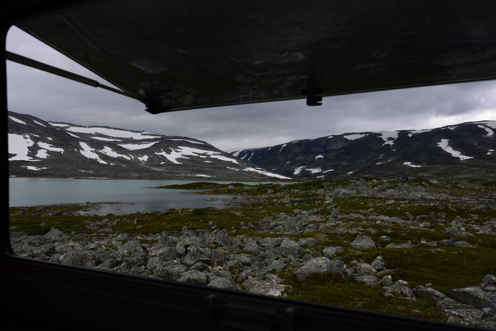
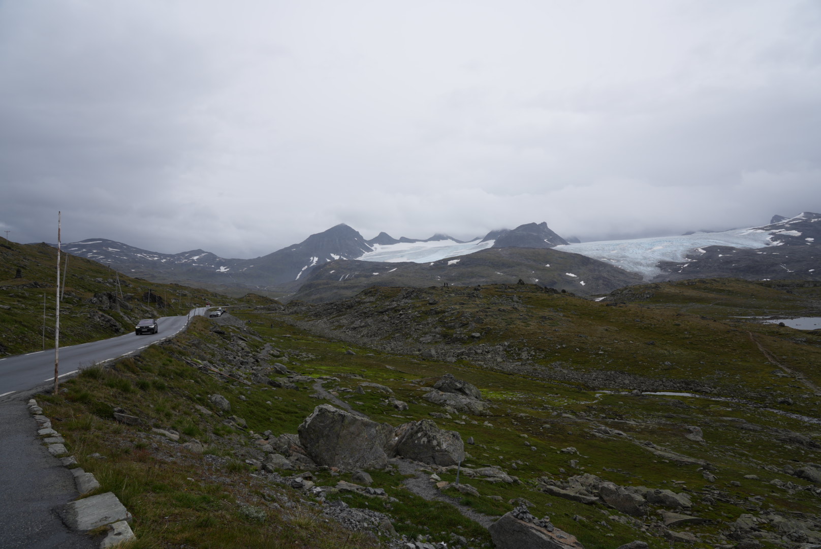
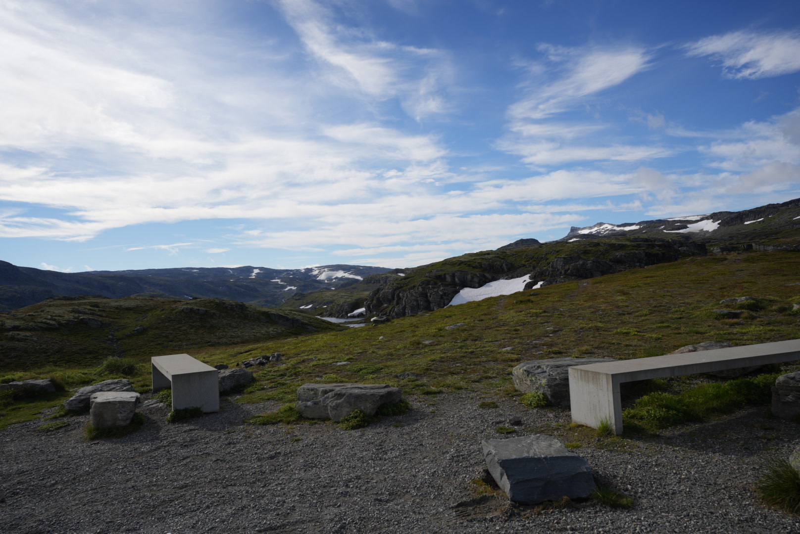
After this extensive rest we can continue. Next up is another tourist road through Sognefjell. Since this is very long and we don’t feel like driving anymore — we’ve already been on the road for a long time this morning — we quickly look for a place to stay. Since we liked the solitude so much recently, we decide to take a cul-de-sac again and drive up a narrow path through the Leirdal to a hiker’s hut. Wild camping is forbidden here, but for a small fee (11€ per person) you can spend the night here in your mobile home and also use the sanitary facilities in the hut.
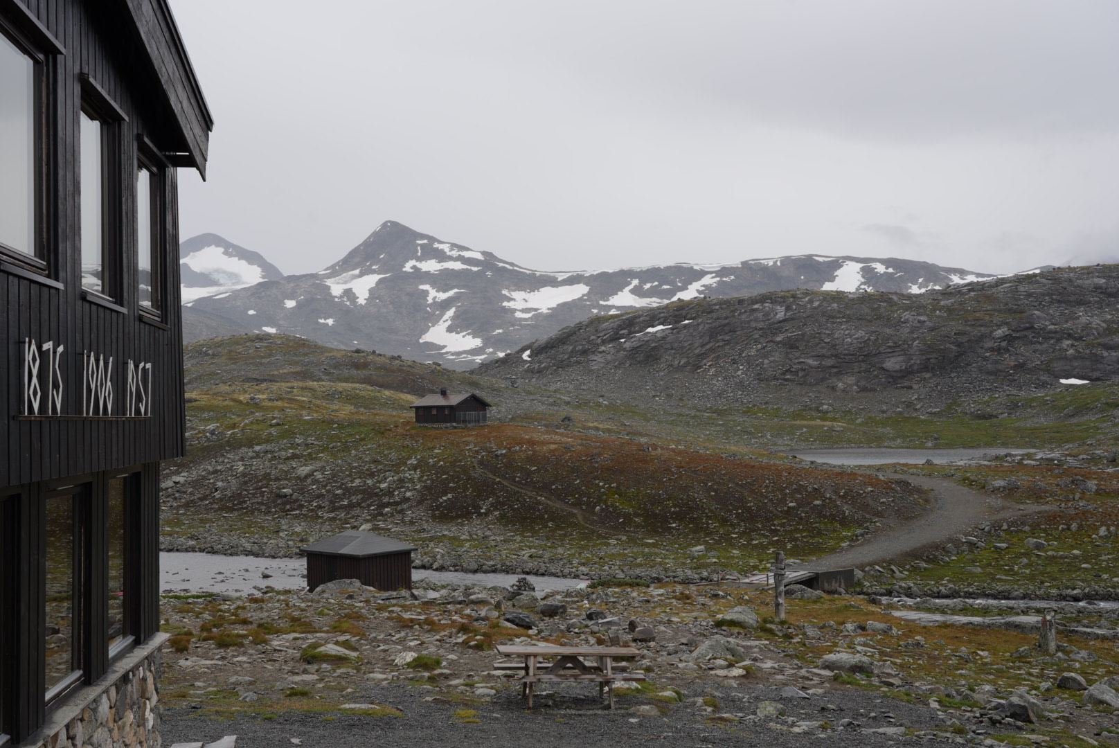
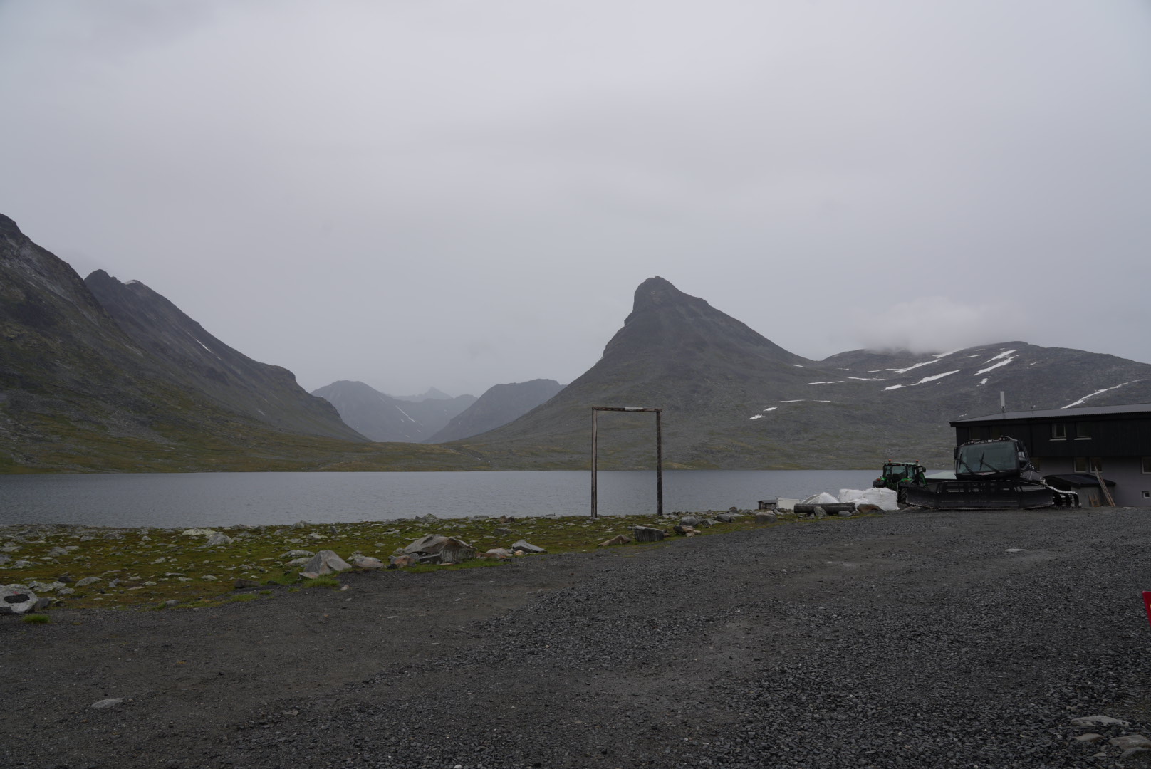
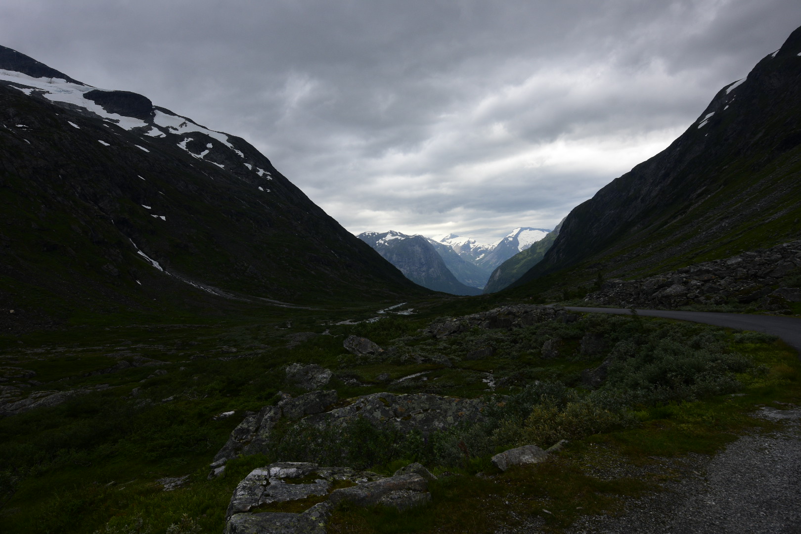
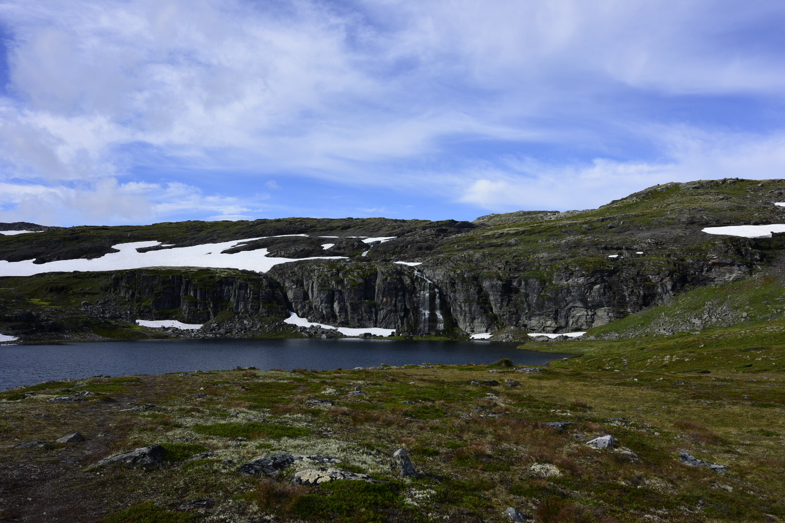
The view is terrific. We are surrounded by over 50 peaks over 2000m high and can see several glaciers and snowfields. Except for the hut and a few cars from hikers, there is nothing to see here but mountains, lakes and meadows. A really barren and at the same time fascinating landscape. On a sign we discover that the region also invites you to sporting activities in winter. Then a large part of the region is developed as a cross-country skiing and ski touring area.
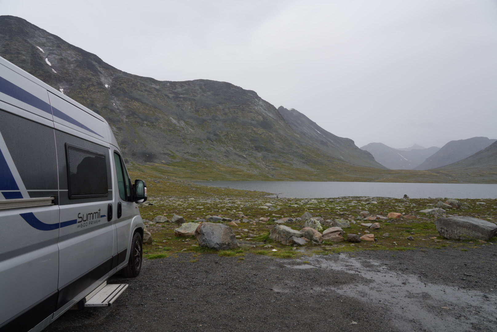
We had actually planned to hike along the large lake directly in front of us and behind a knoll to another lake the next morning. Unfortunately, it rains non-stop and we continue without hiking. This time, enjoying the view here will have to suffice.
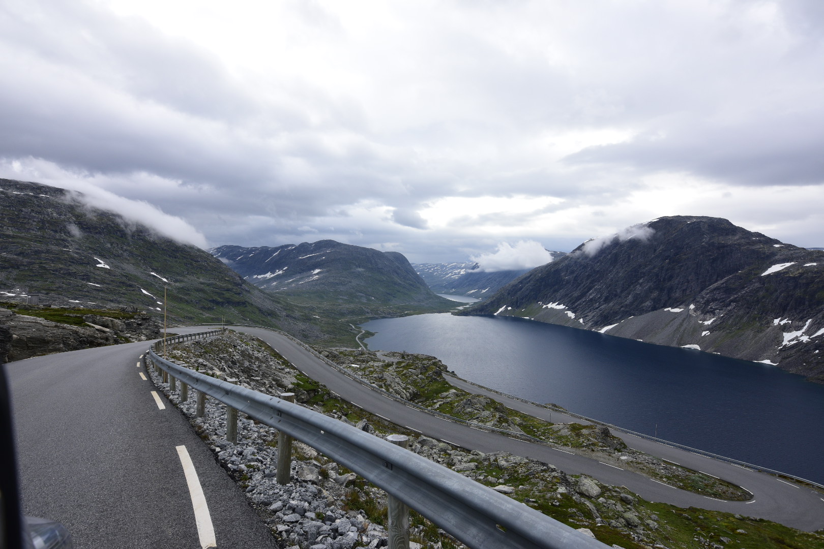
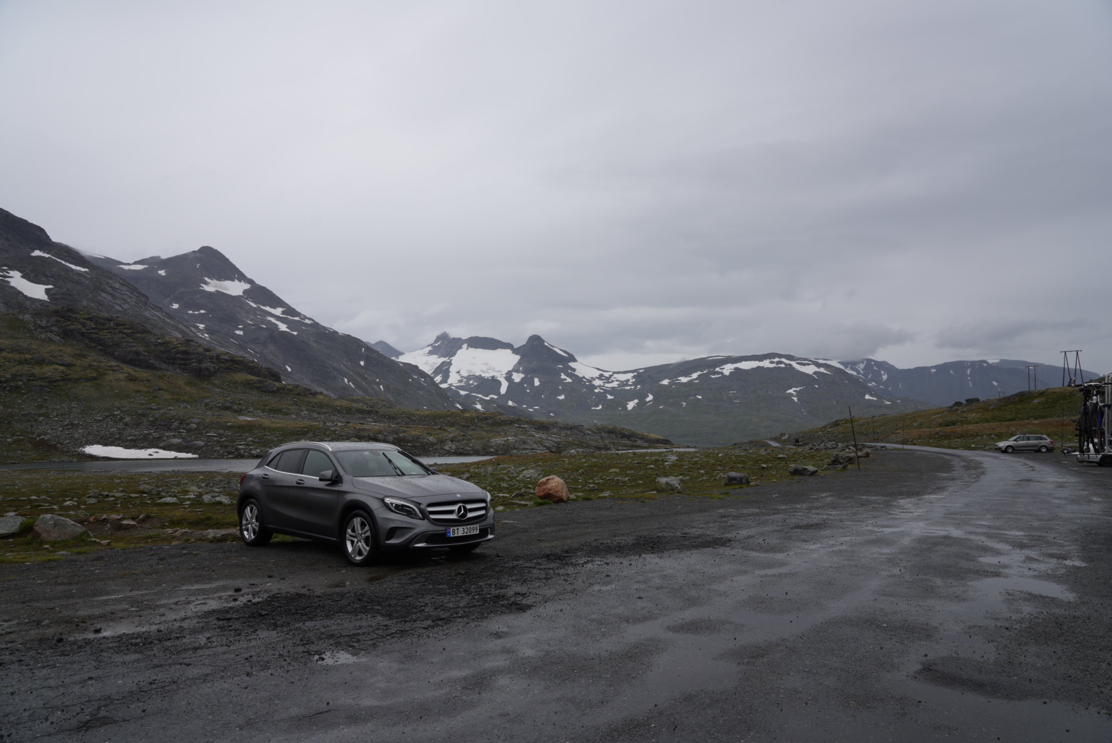
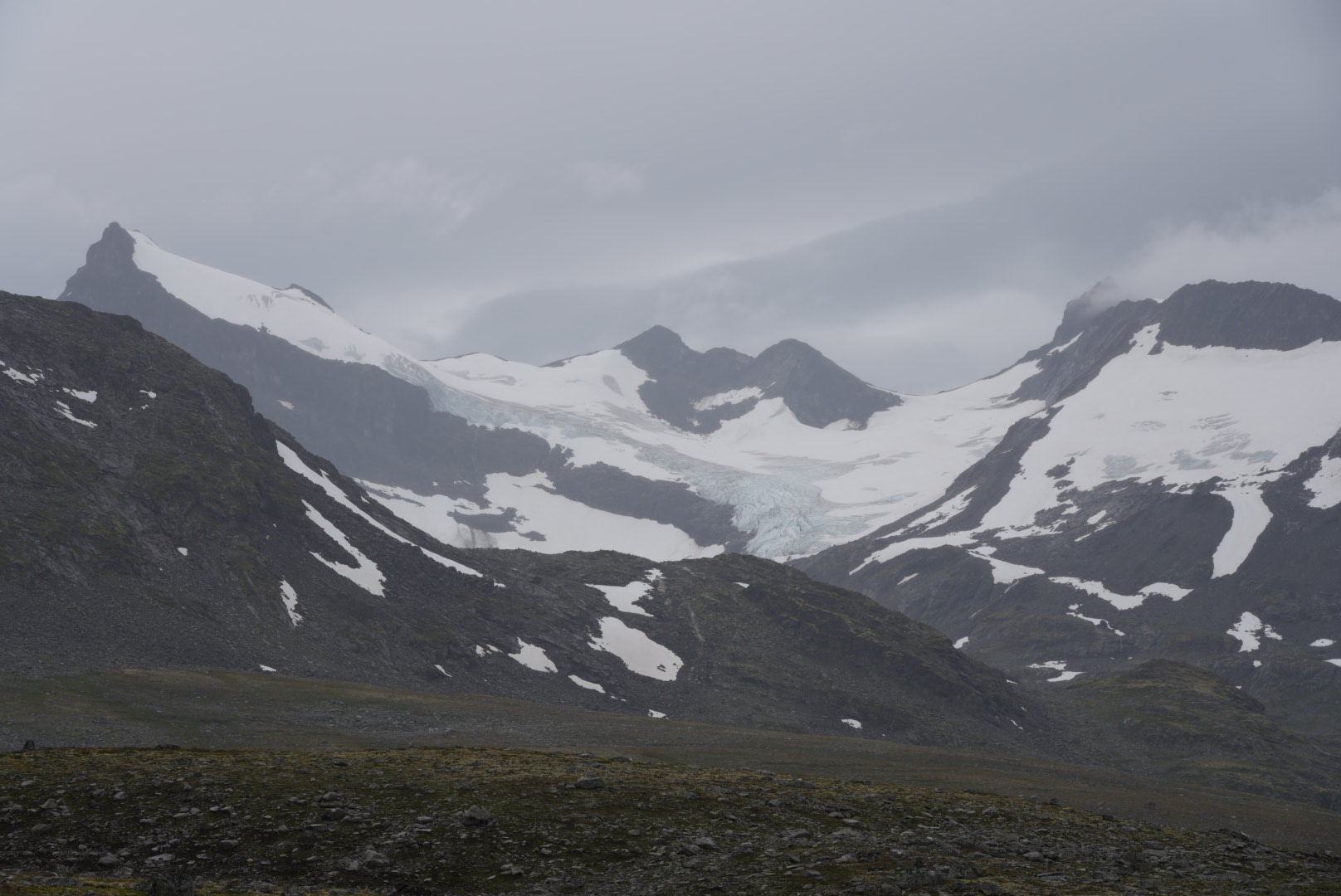
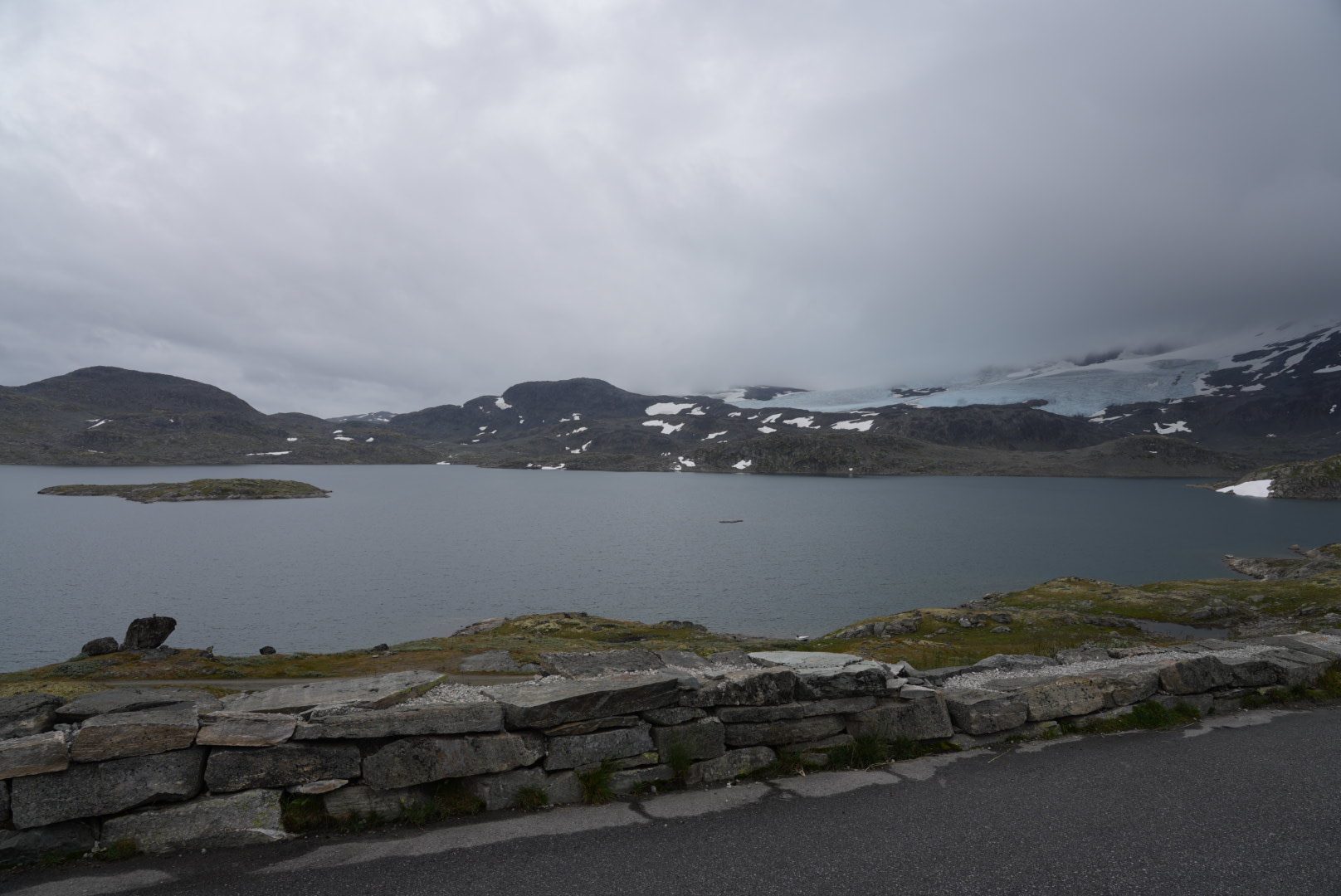
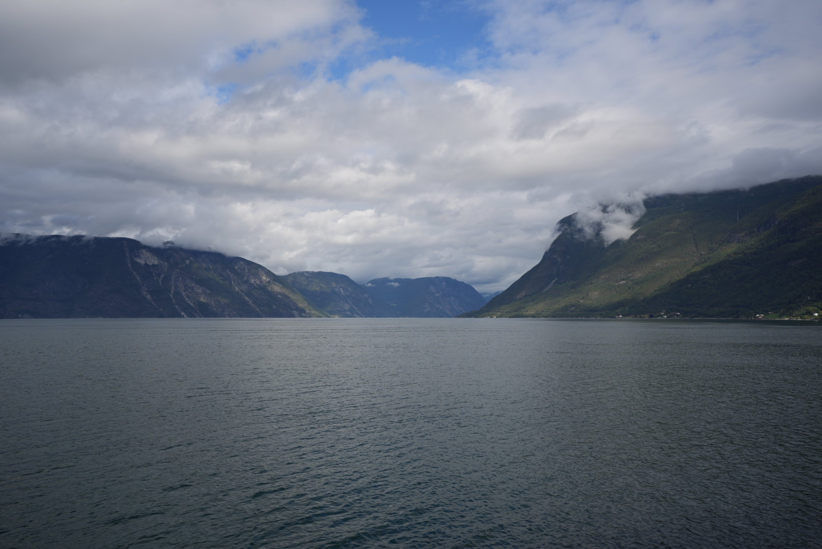
Sognefjellet
With repeated showers, the journey continues as planned through the Sognefjell. And while the Leirdal previously offered glaciers but also solitude at the same time, the Sognefjell is littered with huge glaciers and quite a few other tourists. Fortunately, due to the huge area that you can see from here, this is not too disturbing. The landscape rises too majestically here and shows new facets after every curve. This magnificent road is also the highest mountain pass in Northern Europe.
We often notice road cyclists on the road, some of whom are on the road as bikepackers — i.e. bicycles with minimalist panniers — but also as organized tours with luggage transport. In retrospect, we have already found that as well-known as the Trollstig is, this can only be recommended to a limited extent as a bike route. We would definitely only ride this at the end of the season. Preferably a few days after the road has already been closed to cars in winter. Or in spring just before opening. Otherwise there is just too much confusion here with coaches and general tourist traffic for you to be able to enjoy the bike ride up here. At least this applies to the serpentine Trollstig. The other side down to Geiranger is more interesting to cycle and up to Dalsnibba is also a worthwhile tour.
A bike tour through Strynfjell will probably be even nicer. Here we met hardly any people by car and the road is probably unfamiliar enough that you can enjoy a bike ride here almost alone. However, one should not be too squeamish. There are lots of potholes there.
The Sognefjell is about as crowded as the Trollstig, but the road is wider and is therefore still manageable as a bike tour despite the traffic. Oh, and we didn’t see a single car in Leirdal either on the way there or on the way back. If you’re looking for maximum peace and quiet on your bike, you’ve come to the right place.
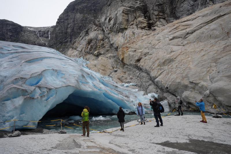
Nigardsbreen
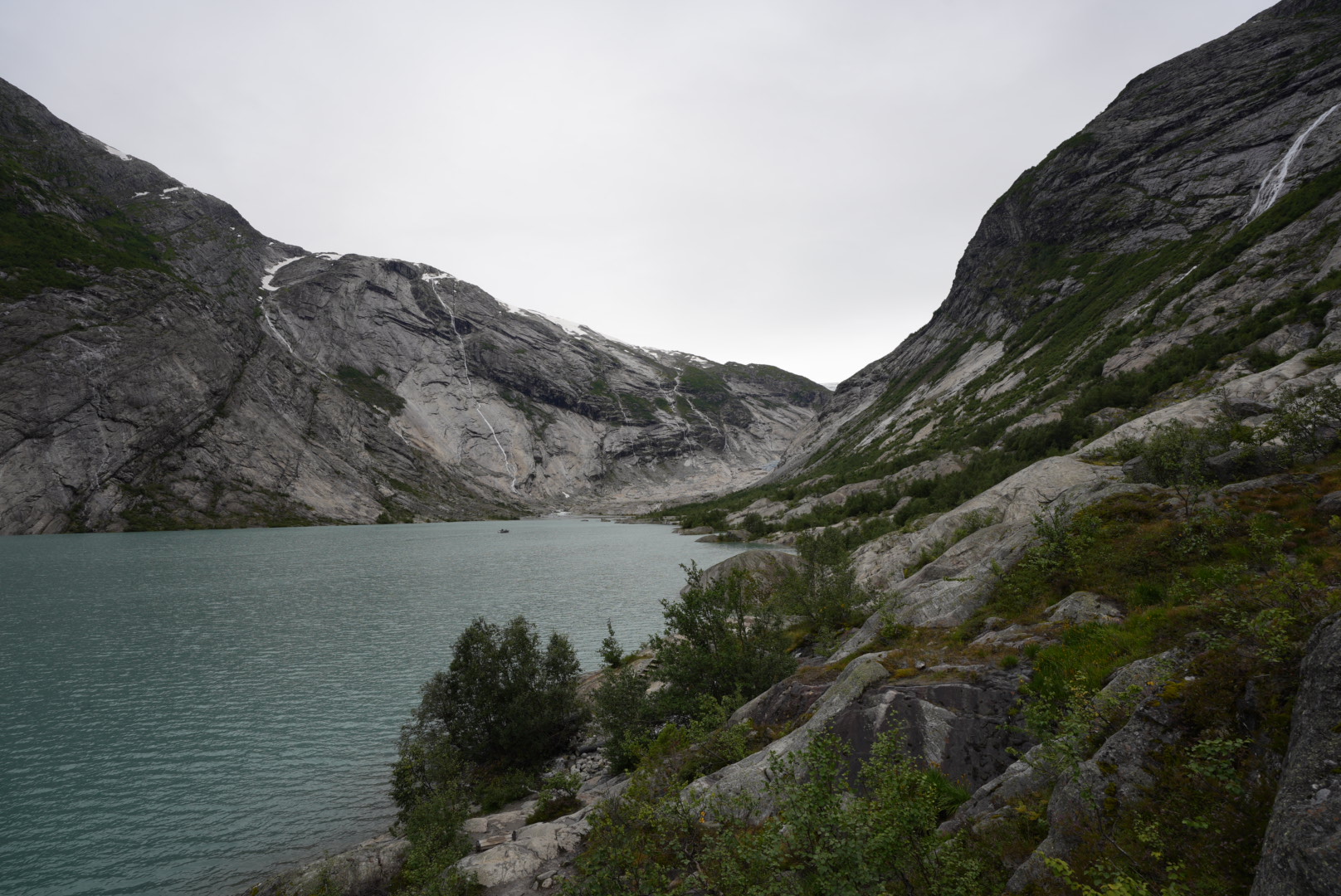
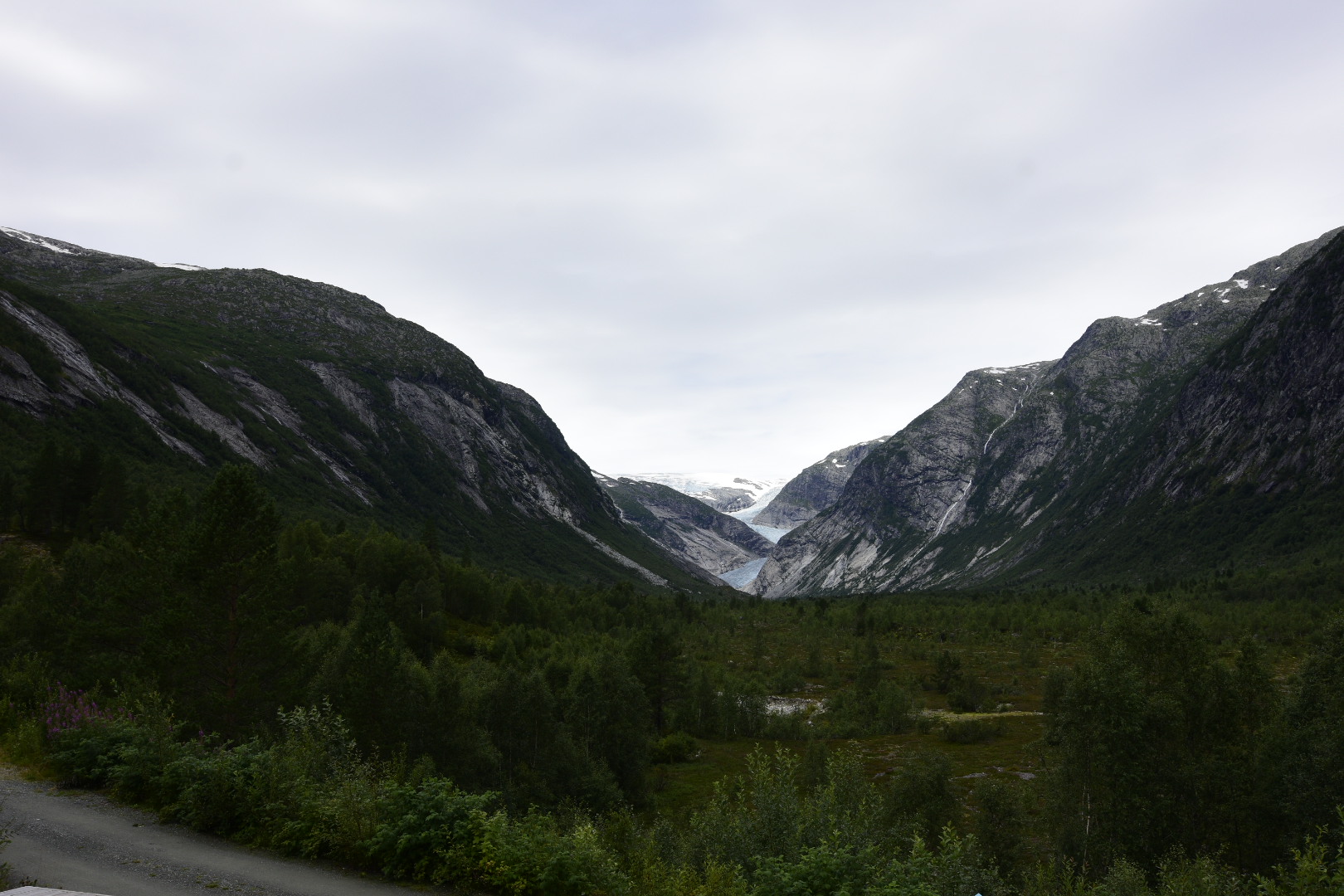
At the end of Sognefjell you descend to the Sognefjord. The road along the fjord always offers great views of the fjord and we literally rush down the valley in search of a new place to stay. This region is not so plentifully equipped with parking facilities and we will probably have to head for one of the scattered campsites. Nobody can really inspire us. But stop! Moment! What was that on the street? Nigardsbreen? — Bre is Norwegian for glacier. A signpost to a glacier? Does that mean you can just drive there? A quick search reveals that you can drive almost there and the Nigardsbreen is the most accessible glacier in Norway. There is a campsite just before the entrance. Well, if that isn’t a goal for next night!
Arrived we get a nice place on the meadow and can enjoy the evening. The woman from the reception gave us a card and so we are ready for tomorrow.
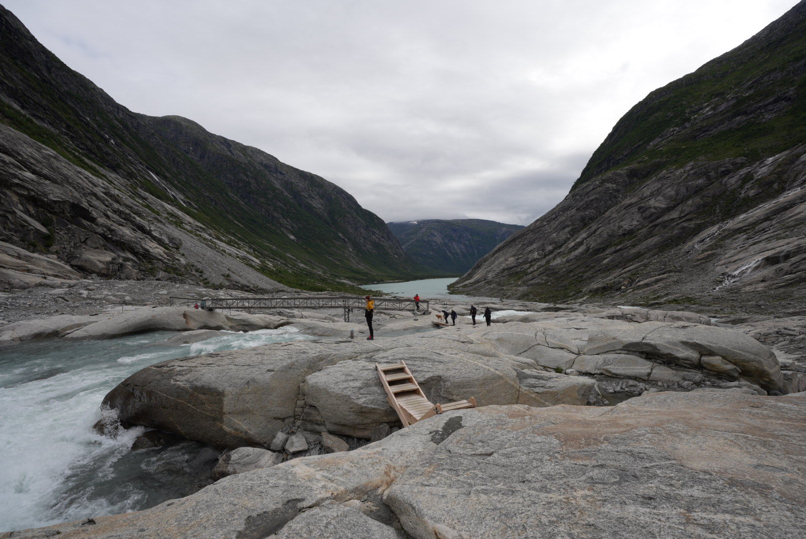
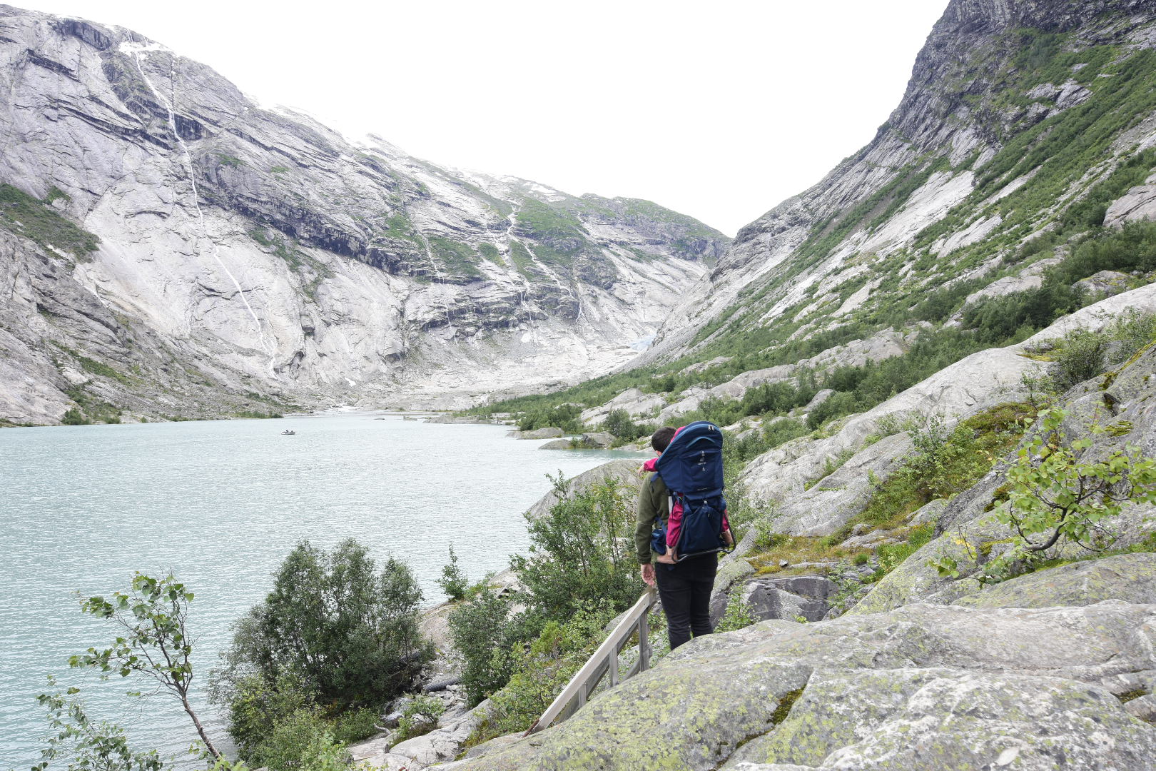
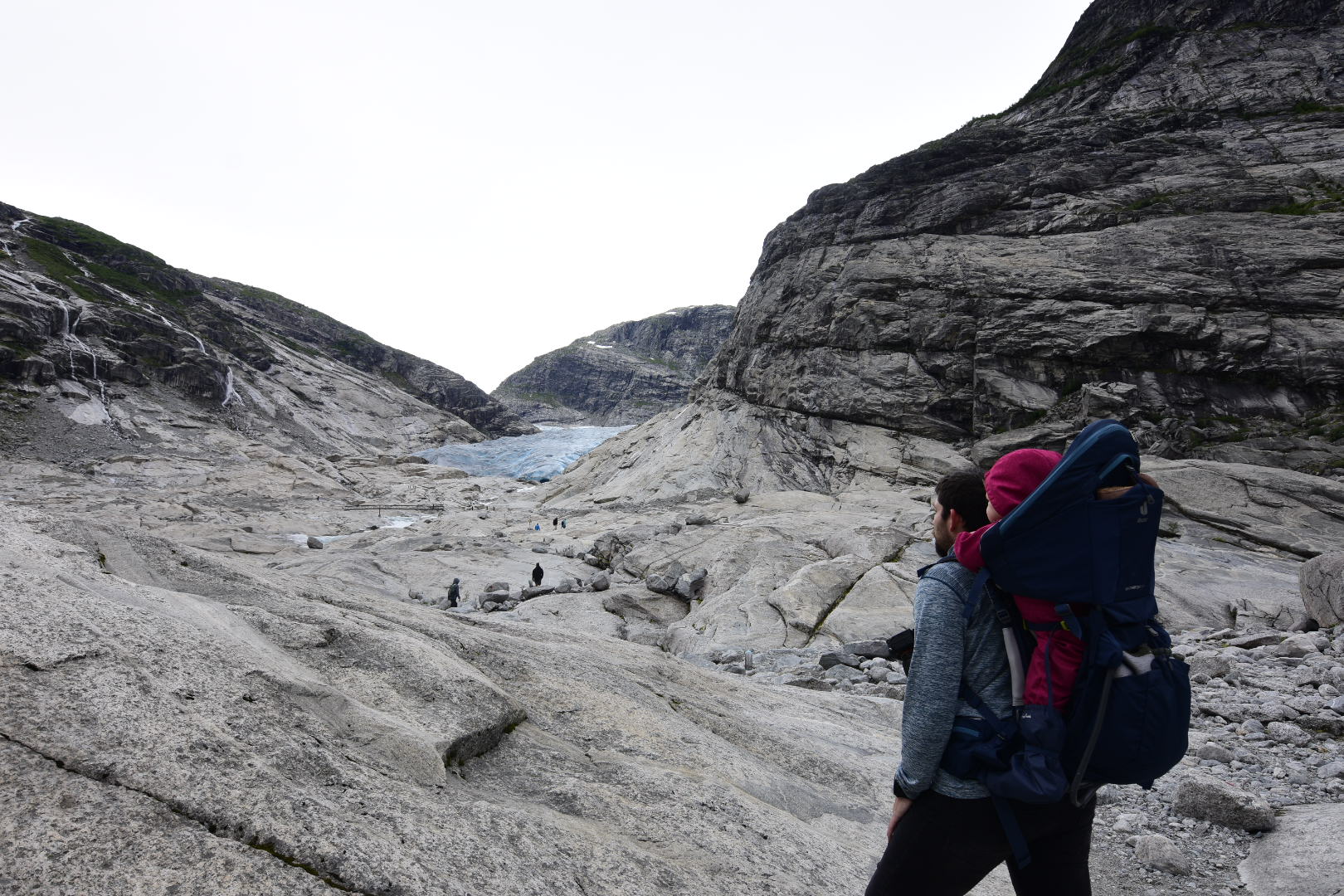
There is also a visitor center again at Nigardsbreen. After the somewhat sobering offer on the Trollwand, we forgo it and drive straight on to the hikers’ car park. From here a path should lead almost 3km directly to the glacier. So the mouse takes a seat in its carrying frame and off we go. The path is worlds easier to walk than our hike to Bispenvatnet. Quite strenuous in places, but so well marked and secured by bridges, stairs and hand ropes that everything is really no longer a problem.
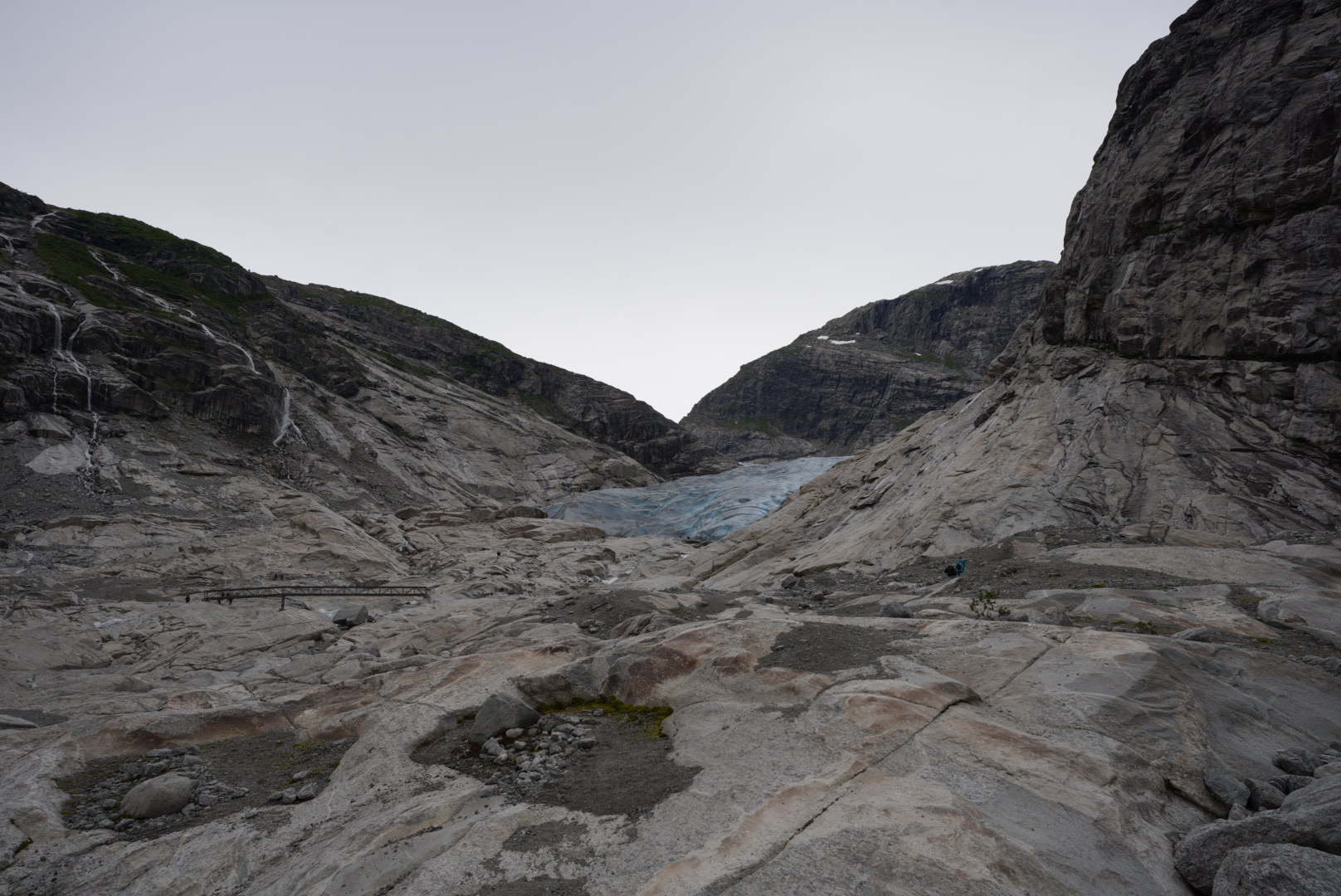
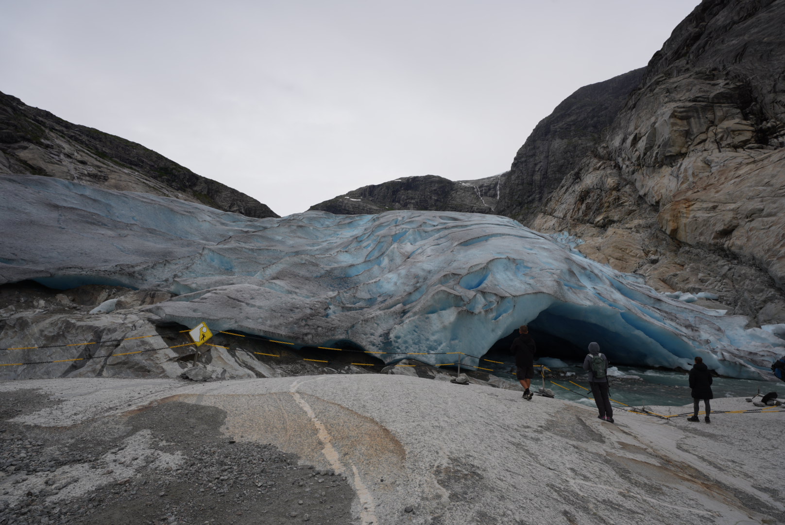
After a good hour you cross a bridge over the glacial river, which is fed by the meltwater of the same. Here even larger pieces of glacial ice are floating in the water. The glacier is then huge right in front of us. Up to approx. 50m you can approach directly, look into the cave, from which the meltwater runs out in masses. A truly impressive spectacle. It is also interesting to learn how the cold air over the glacier literally shoots down into the valley. We are met by a strong, really ice-cold wind from the glacier. None of us can stand it long here and so we quickly make our way back. Now with a little more downhill than uphill, we only need three quarters of an hour and are back at the car. Time for a short lunch break.

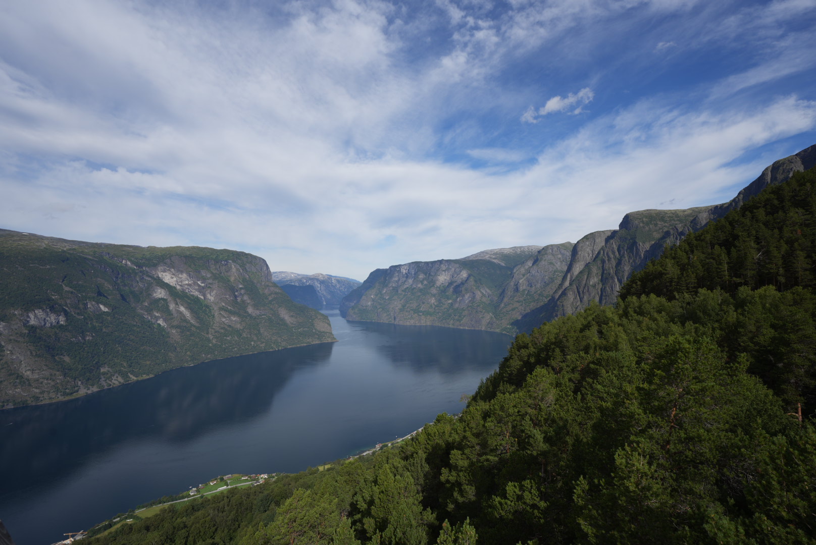
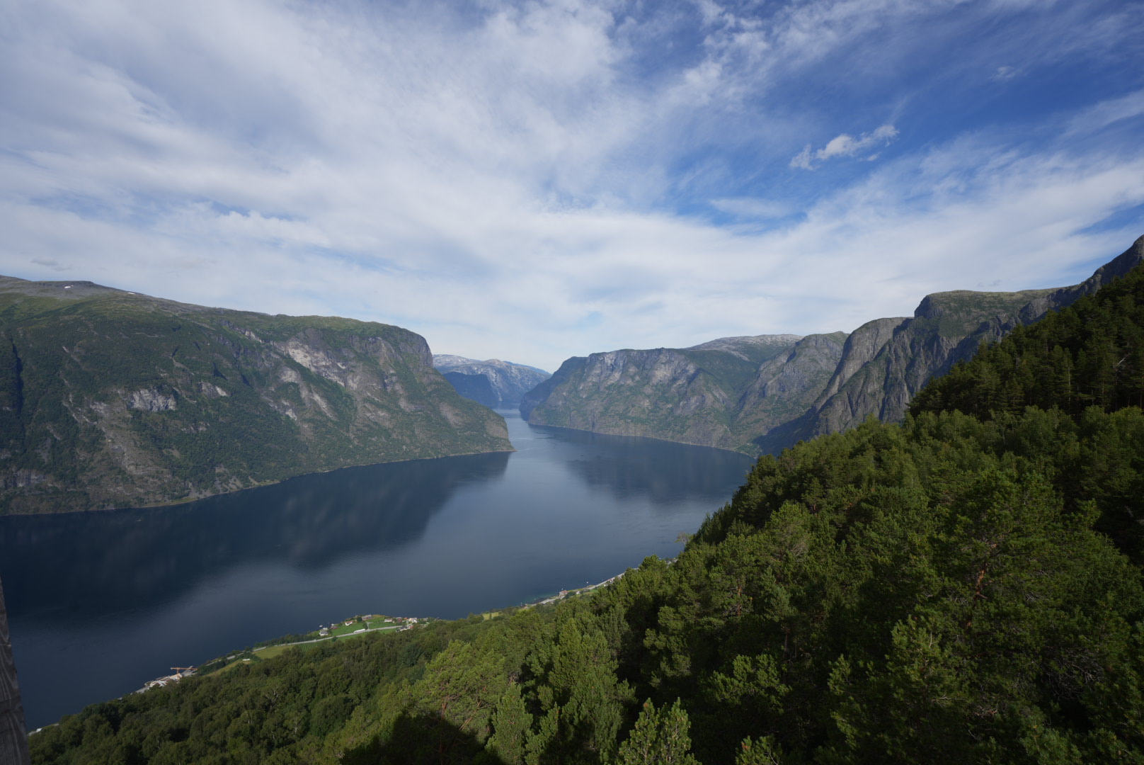
Aurlandsfjell
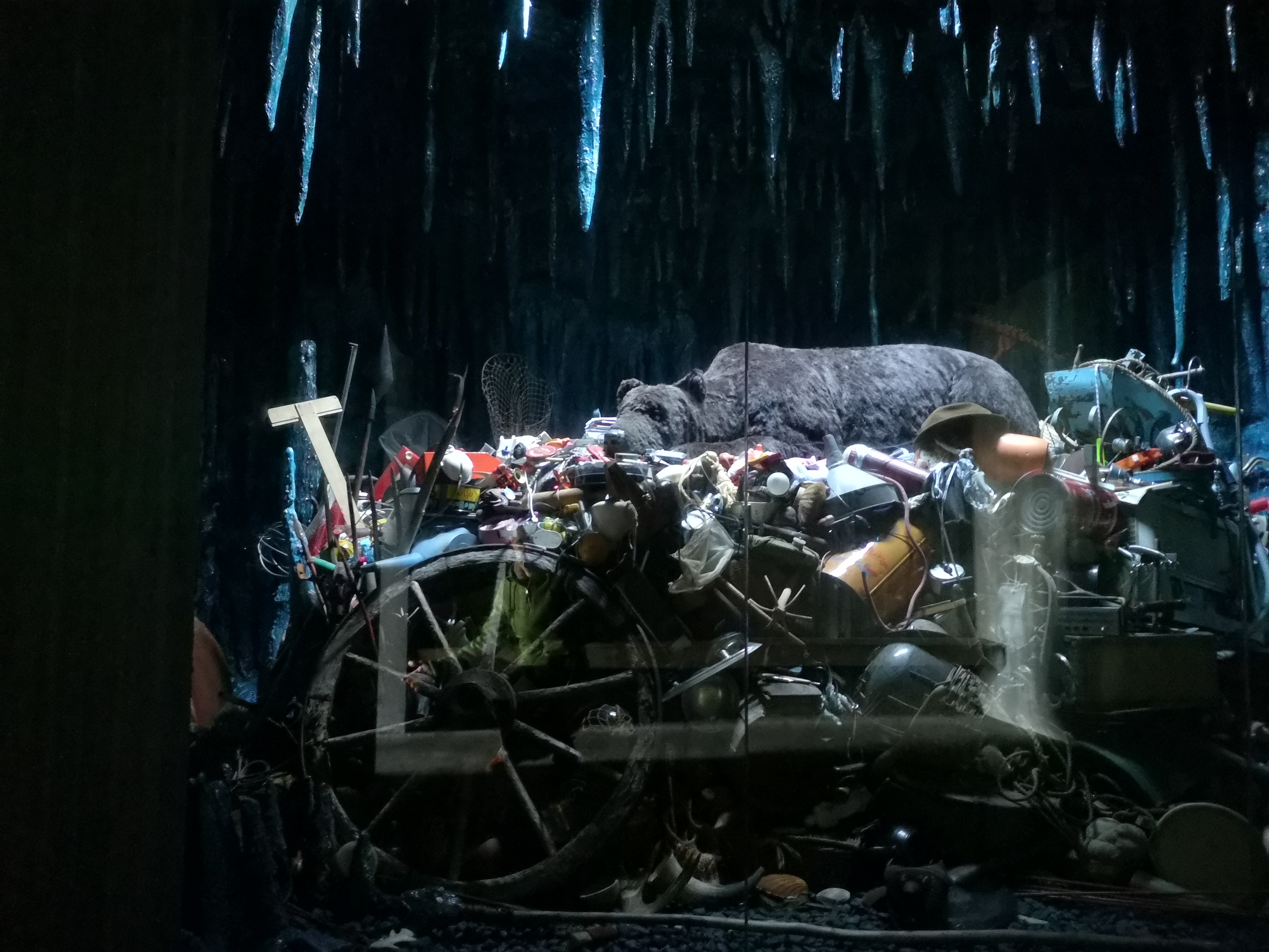
Our next destination are the towns of Aurland and Flåm. There are two routes to get there. The new one leads through the longest tunnel in the world, the old one over a plateau, the Aurlandfjell. It goes without saying that landscape interests us more than 25km of subterranean rock. So it goes up to the Vedahaugane viewpoint and its somewhat strange cave. What shouldn’t all be art… In any case, we can spend the night well here and the next morning we are right at the start of the next tourist road. Those through the Aurlandfjell.
Here, too, there are wonderful expanses to admire, individual lakes, the occasional glacier in the distance and at the beginning also wet meadows and slopes, which with their ferns could almost be a kind of subarctic rain forest.
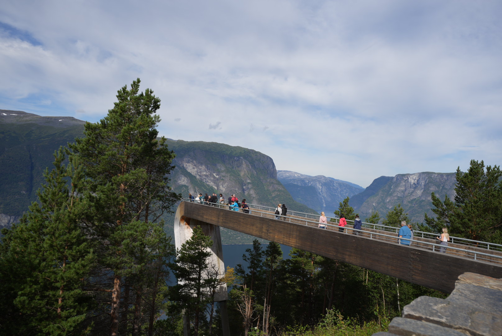
Stegastein
At the end of this street we pass the Stegastein viewing platform. Here, numerous tourists are carted up by Aurland, the rest drive up themselves. The street and the parking lot are correspondingly full here again. A bike tour is also recommended here, if only in off-peak times.
We can marvel at the view just before the masses arrive with only moderate activity and drive on immediately.
Flam
Last night at the cave we had no internet reception and could not prepare our daily program. At the stop at Stegastein, however, we had to realize that our two targeted points, a ferry ride and a train ride, would both take place in Flåm, if at all. We don’t know what can be done in Aurland. So let’s skip it for now.
Unfortunately, all ferry and train tours are fully booked for today. We’re a bit at a loss as to what to do instead. You can also hike up the railway line or ride a bike. That would only be 20km. Not really far. A check on komoot predicts more than 800 meters in altitude. With our trailer it could be more sporty.
But we still find the solution in the tourist office. We can book a single ride up for all of us plus our bikes and trailer and then just do the downhill ride. That sounds perfect!
Flamban and Myrdal
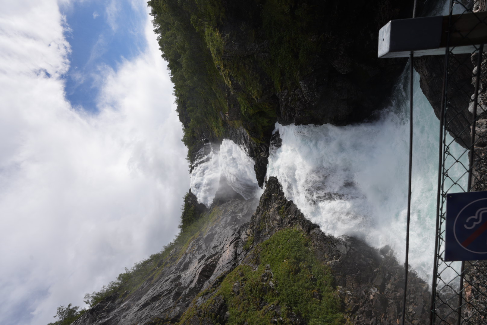
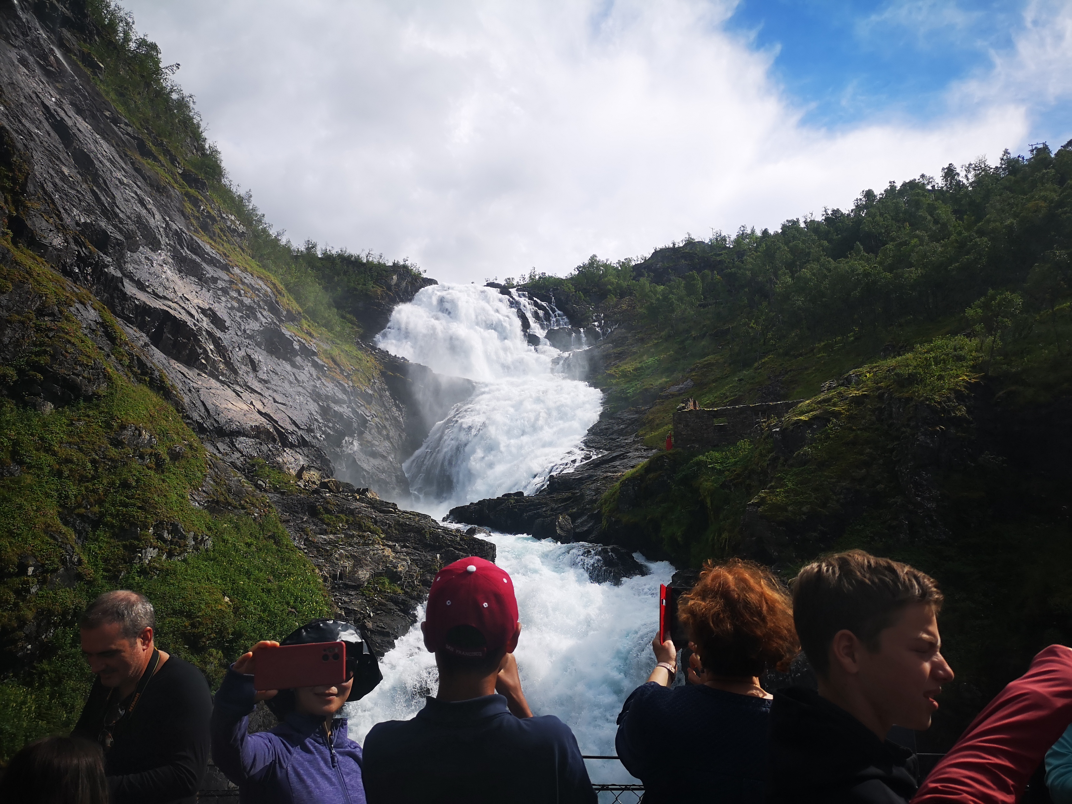
Said and done. With only 45 minutes of preparation time, the bikes are unpacked, pumped up, the car hitched up, food bought and we stand on the platform and look a little irritated for someone who can tell us where we actually have to go now. The bikes are then quickly professionally loaded and 10 minutes before departure we take a seat in our sports clothes among all the other tourists who will probably be on their way back hiking or with rented mountain bikes. Our train only takes passengers upstairs. The railway meanders upwards over its 20km through a very narrow valley. It goes through a total of 20 tunnels and the route, which climbs over 800 meters in altitude, originally took around 20 years to build. There’s even a 5-minute stop at a waterfall along the way to take photos. Shortly afterwards we can see the switchbacks of our bike path. The last part of the ascent to our starting point Myrdal is very steep and therefore divided into 21 hairpin bends. Good that we only want to go downhill and not uphill.
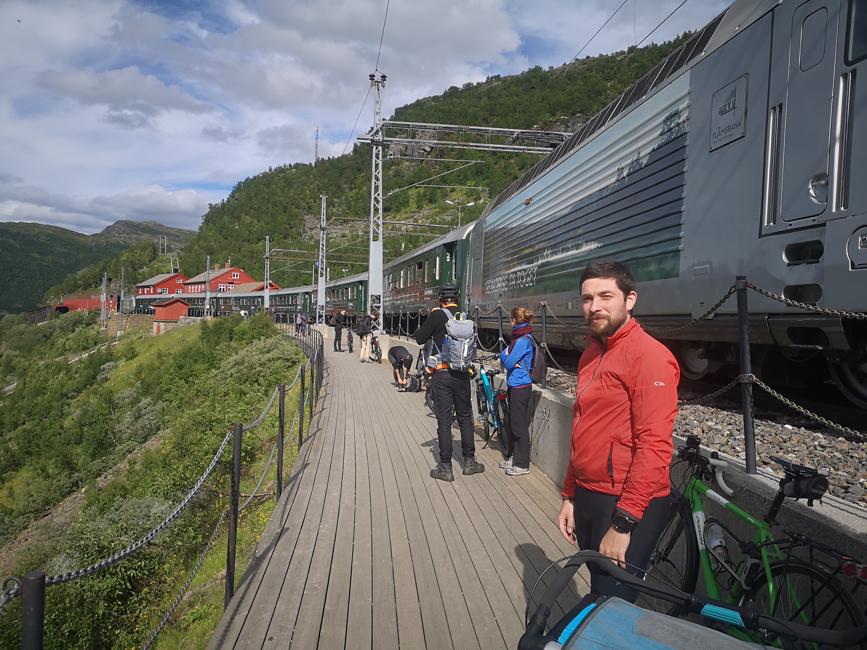
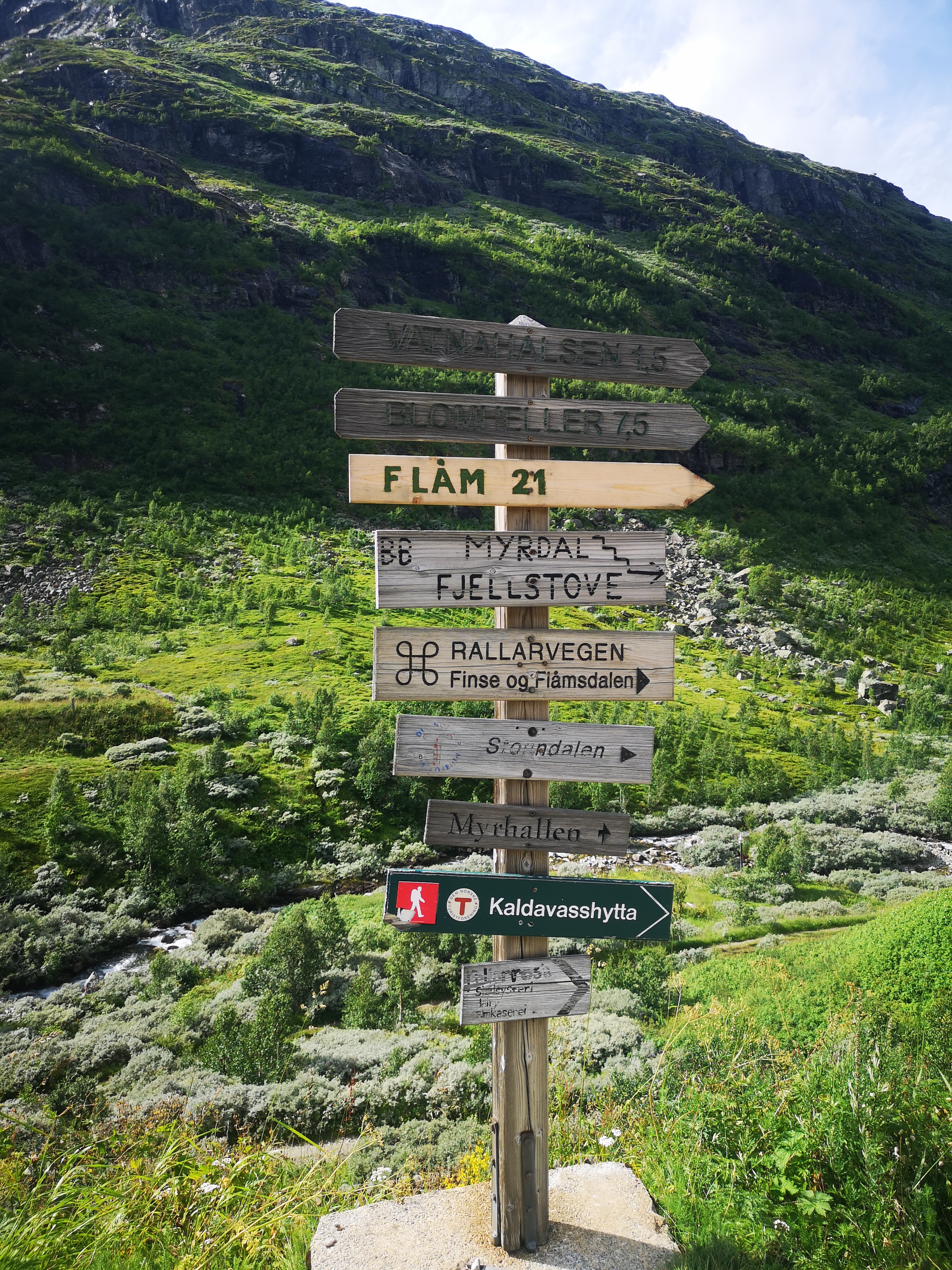
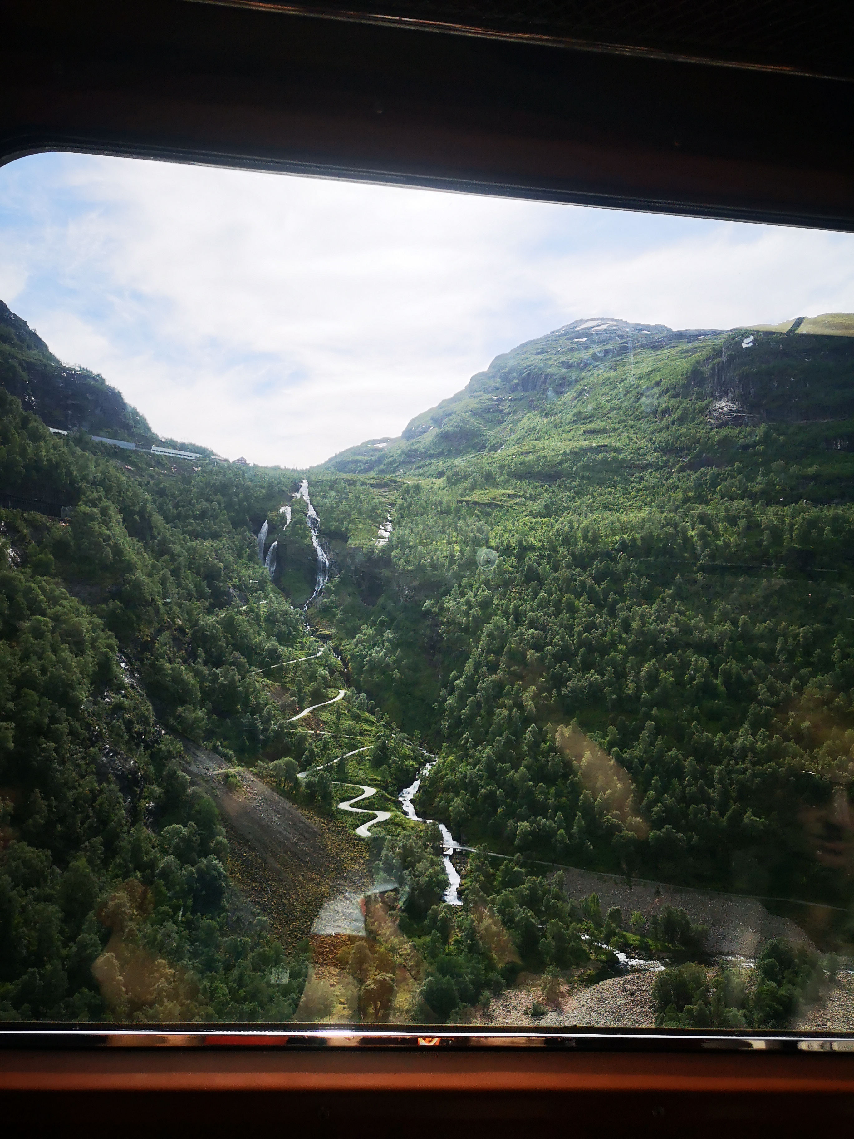
At Myrdal train station we are almost surprised that it really worked as easily as the woman at the ticket counter had promised. Both our bikes and the trailer for the mouse have arrived safely at the top and in no time at all we are ready for our leisurely descent into the valley - at least that’s how we had imagined it. Immediately after crossing the tracks, however, we find a fairly coarse gravel hiking trail that most mountain bikers still push downhill. We don’t even think about trying to ride it and push our bikes downhill for the first 100m. Then it can finally start and we roll the first meters. Until we find a sign after maybe another 200m “steep descent, tight curves, push your bike!”. Ok, let’s do that then. We won’t know until the end whether that was just this one curve or the 21 switchbacks that we’ve already seen off the track. In any case, the path remains so loose and soft and at the same time so steep that we have to push our bikes and the trailer downhill for all the hairpin bends and thus a total of approx. 1.5km. Oh well. My bike, the one with the trailer, would probably brake sooner. Because with this gradient and the loose ground, the brakes fail and are no longer sufficient to brake the team. So Anne always walks ahead a bit, deposits her bike in a curve, comes back and while I brake the bike from below, Anne brakes the trailer from above and this is the only way we can master many of the steeper sections. No wonder that, according to her GPS watch, Anne covered almost 3km during this 1.5km section. On the Internet, this single journey by train was also called a cycling and hiking ticket. Somehow we just didn’t realize that you also have to cycle AND hike.
However. After we have the steep switchbacks behind us, we are back in our element on a firmer forest path and with not quite as much gradient and rush down the mountain. Now we can really enjoy the tranquility of this valley, which is almost impassable by car.
Stalheim
Our somewhat unplanned hiking highlight in the evening has meant that we are now a little late. We drive quickly through Stalheim and spend the night at a lake shortly after. Stalheim was probably the first tourist town in Norway. It was easy to get to from Bergen and before that it was an important post office on the Oslo-Bergen route. People there were used to brisk travel and the first hostels and accommodations were available early on. Even Kaiser Wilhelm II spent his vacations here several summers in a row.
Voss
After spending so much time in the car over the past few days and experiencing a lot, today is definitely a day off to rest. We drive only half an hour further to Voss. A slightly larger place, which seduces us to stroll with its many shops. On the way we made a quick shopping stop and stocked up on new gas. Luckily our Danish bottle system is 1:1 compatible with the Norwegian one and all we have to do at the machine is swap our old bottle for a new one. Pretty easy!
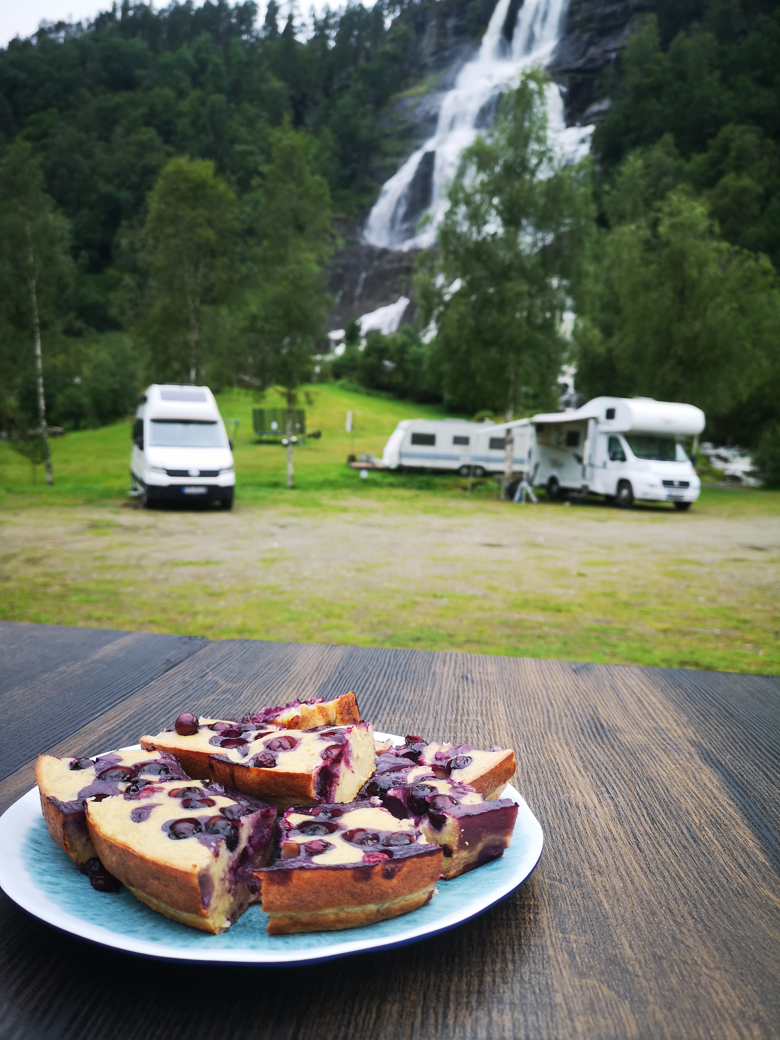
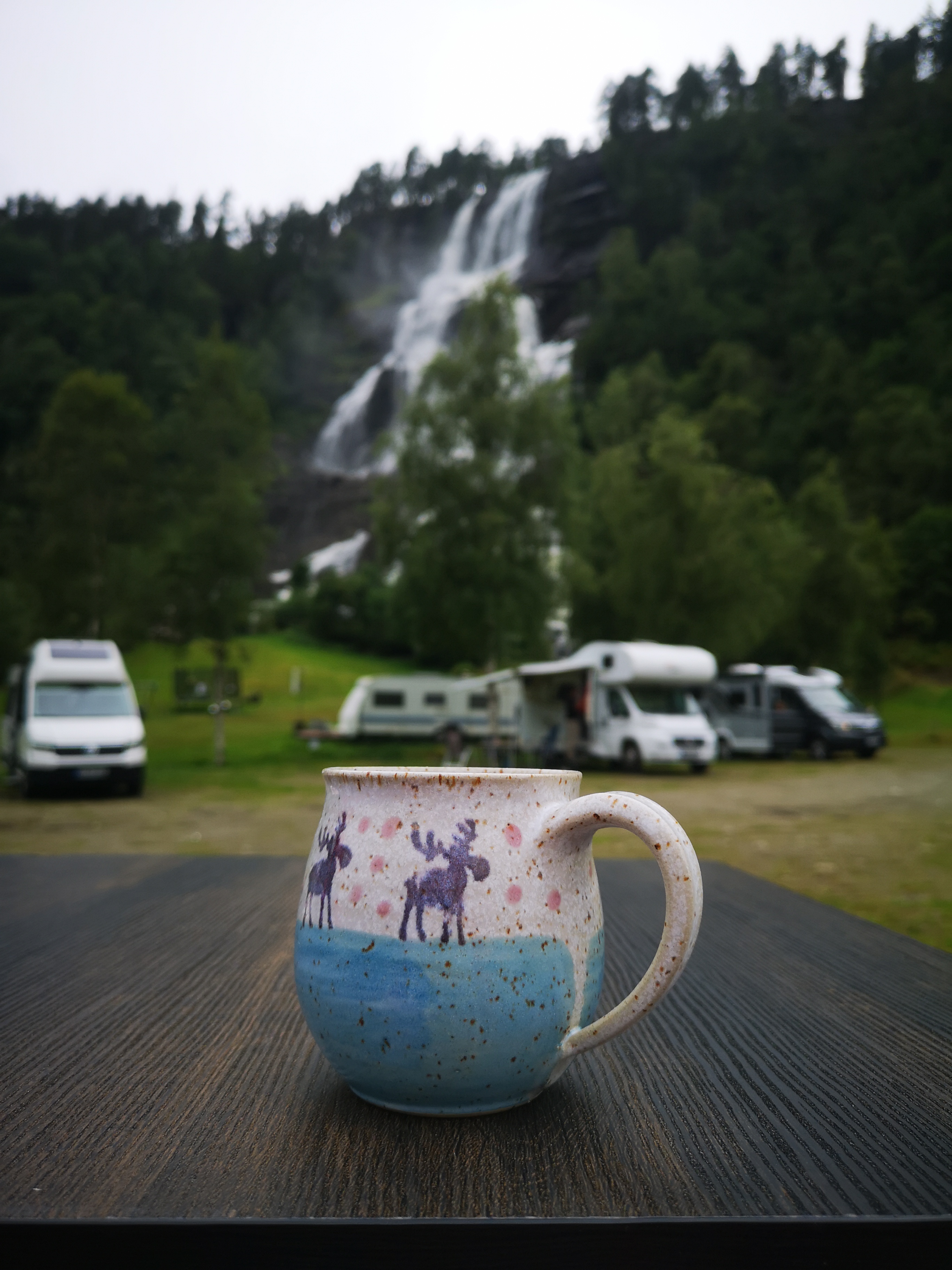
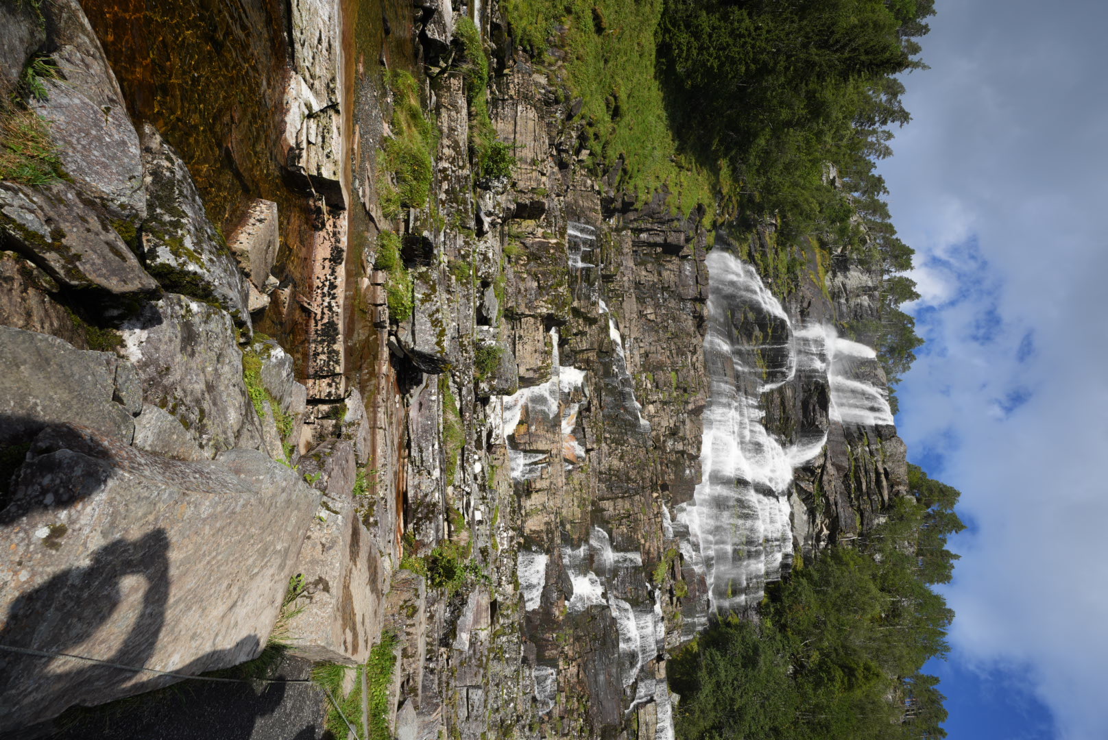
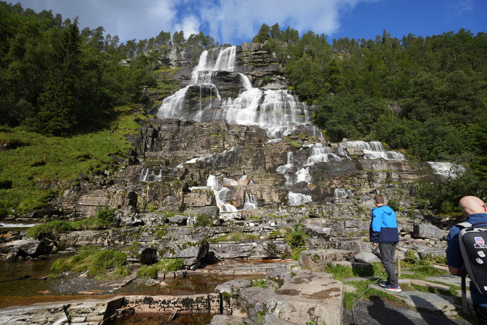
Tvindefossen
This time we chose a campsite just before Voss for the night. There is also the Tvindefossen waterfall, which can be seen directly from our pitch with its thundering masses of water. Maybe 200m in front of us the water falls down the wall. With this backdrop we can finally wash our laundry, play with the mouse with the little stones on the square, bake cakes and simply enjoy life in nature.